Washington · December 2014
Hike Summary
Distance:
6 miles loop
Total Elevation Gain:
1,500 ft
Starting Elevation:
5,400 ft
Highest Point:
5,760 ft
Hike Time:
5 - 6 hrs
Difficulty:
Difficult
Snowshoe Season:
December - March
Dogs:
Not Allowed
Pass Required:
Walking a loop from the Paradise Visitor Center to the Mazama Ridge and Reflection Lakes lets you experience a great variety of Mt. Rainier scenery in a moderate distance.
This route is usually hiked in the summer, when the trail is more obvious, but with the right timing and preparation, it is an excellent snowshoe option in the winter.
This hike requires good wayfinding skills and should only be done in clear weather and plenty of daylight.
You will want to finish the hike while there is still daylight, as the gate down at Longmire is locked for traffic in both directions early during the winter.
The visitor center has a decent trail map of the area, and the park rangers can tell you what to look for at various points along the way.
If the complexity or length of the route is too much for you, there are ranger-led snowshoe tours of the area that usually begin after the Christmas holiday.
The guided tours will take you to the Mazama Ridge and back the same way instead of completing the loop by heading toward Reflection Lakes.
You can begin the hike on one of two routes.
The first option involves walking north on the closed section of Paradise Road past the visitor center, heading towards the Fourth Crossing Trail.
Heading north from there, the trail intersects with the Skyline Trail, where you will turn east to the Mazama Ridge trail.
The more scenic option starts west of the Paradise Inn, where you will climb the Skyline Trail and proceed north toward Myrtle Falls, then continue east to the Mazama Ridge Trail.
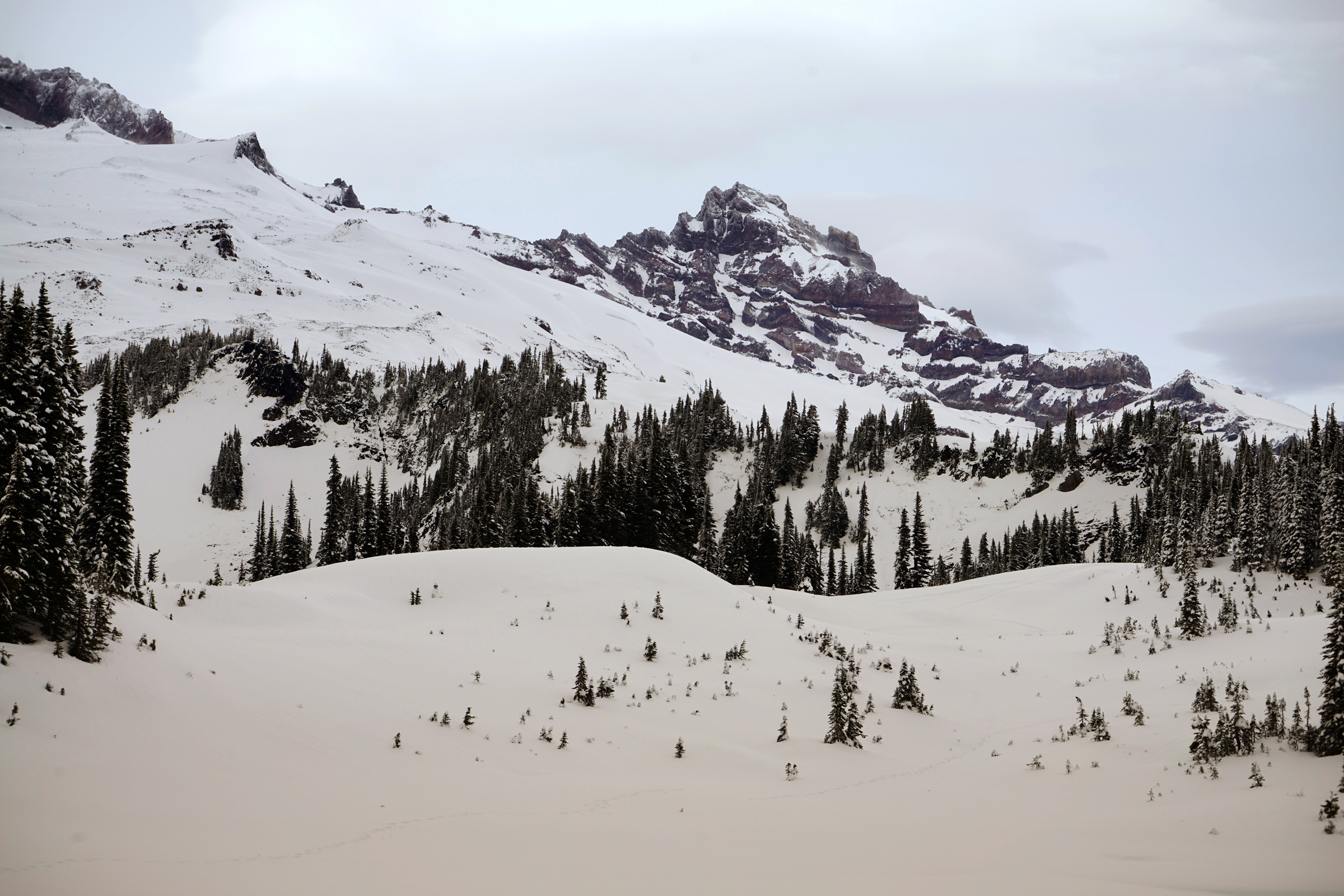
First views of the Tatoosh Range while ascending the Skyline Trail
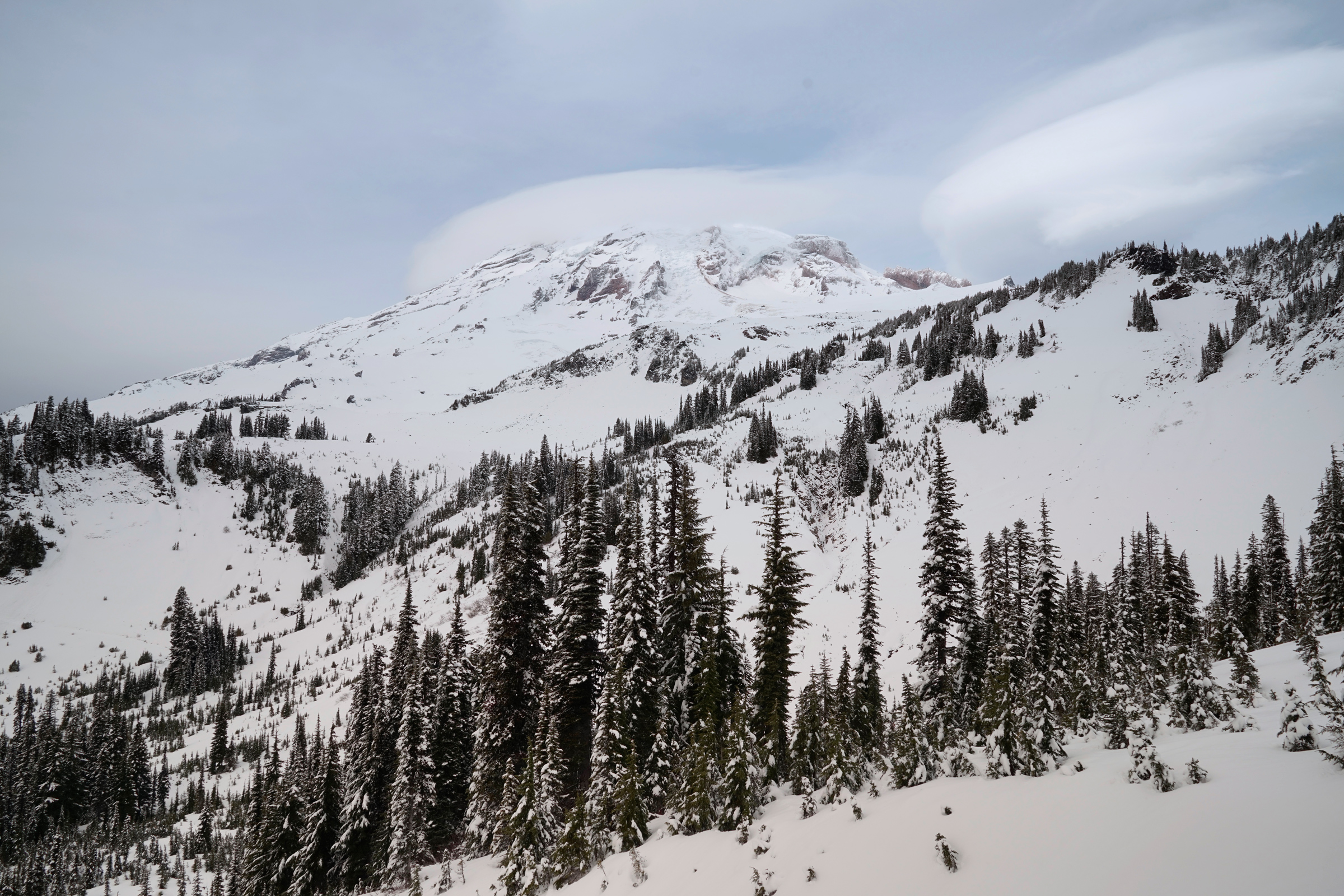
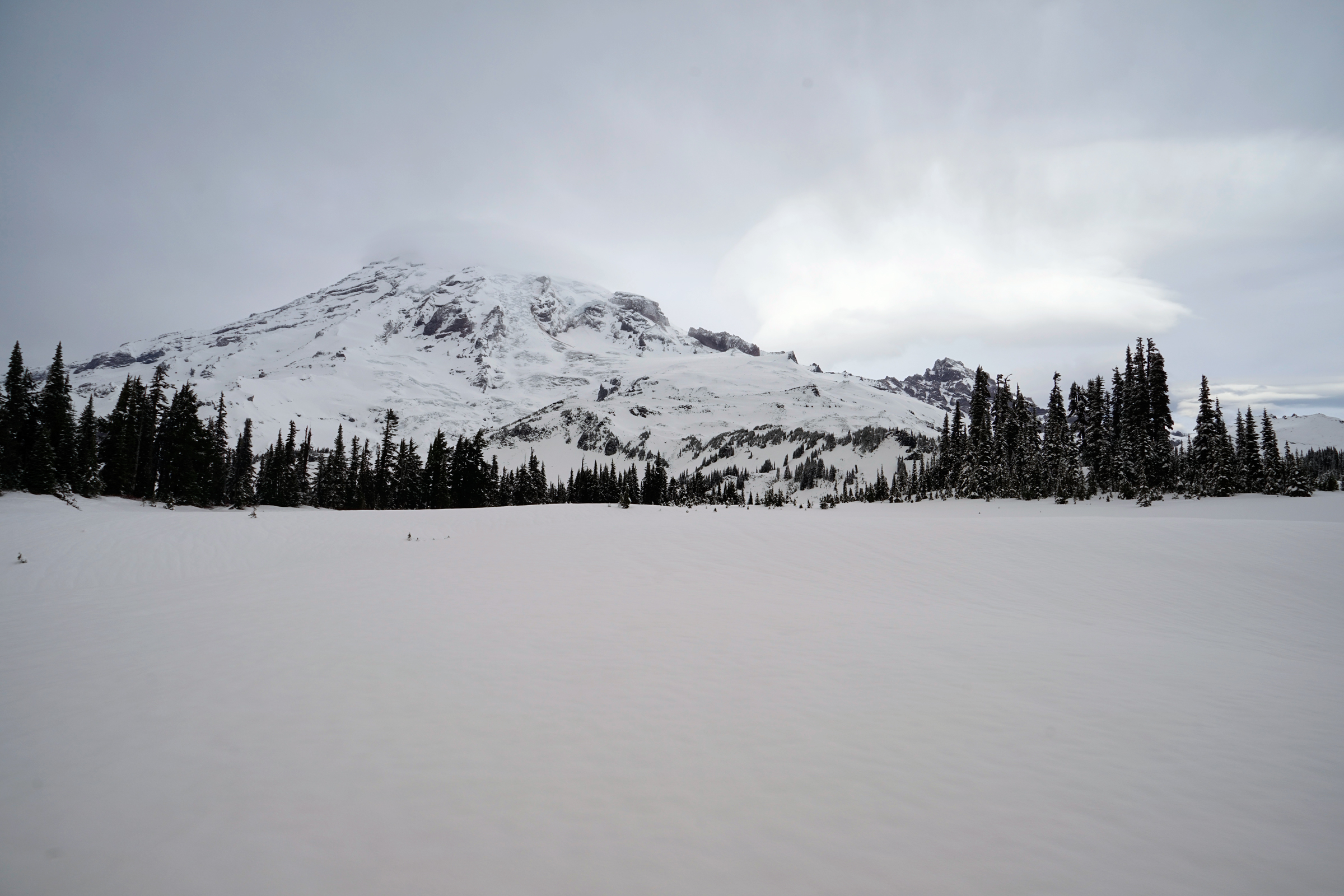
Mt Rainier from the Skyline Trail
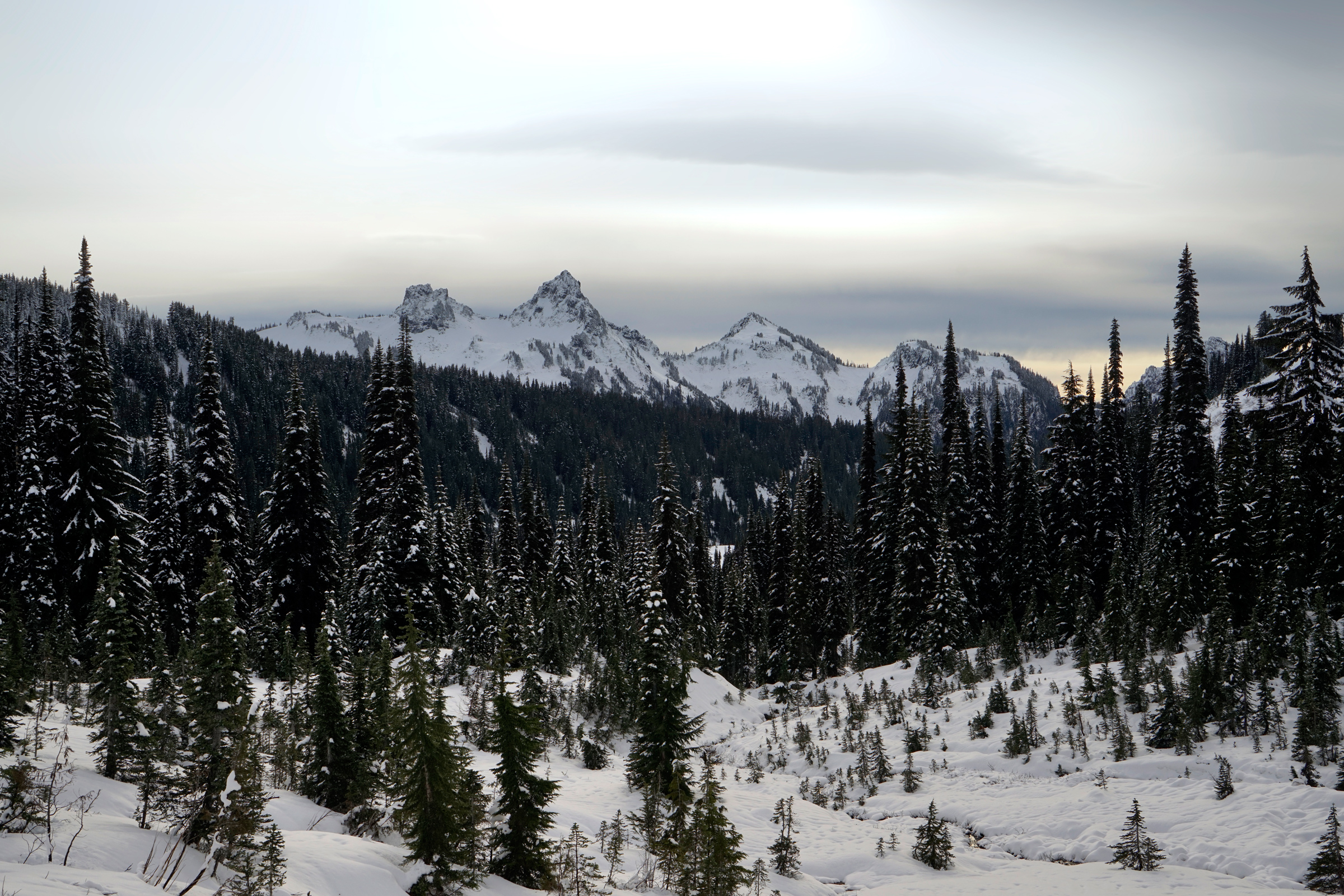
Walking south on the Mazama Ridge, the Tatoosh Range will seem like a stone's throw away.
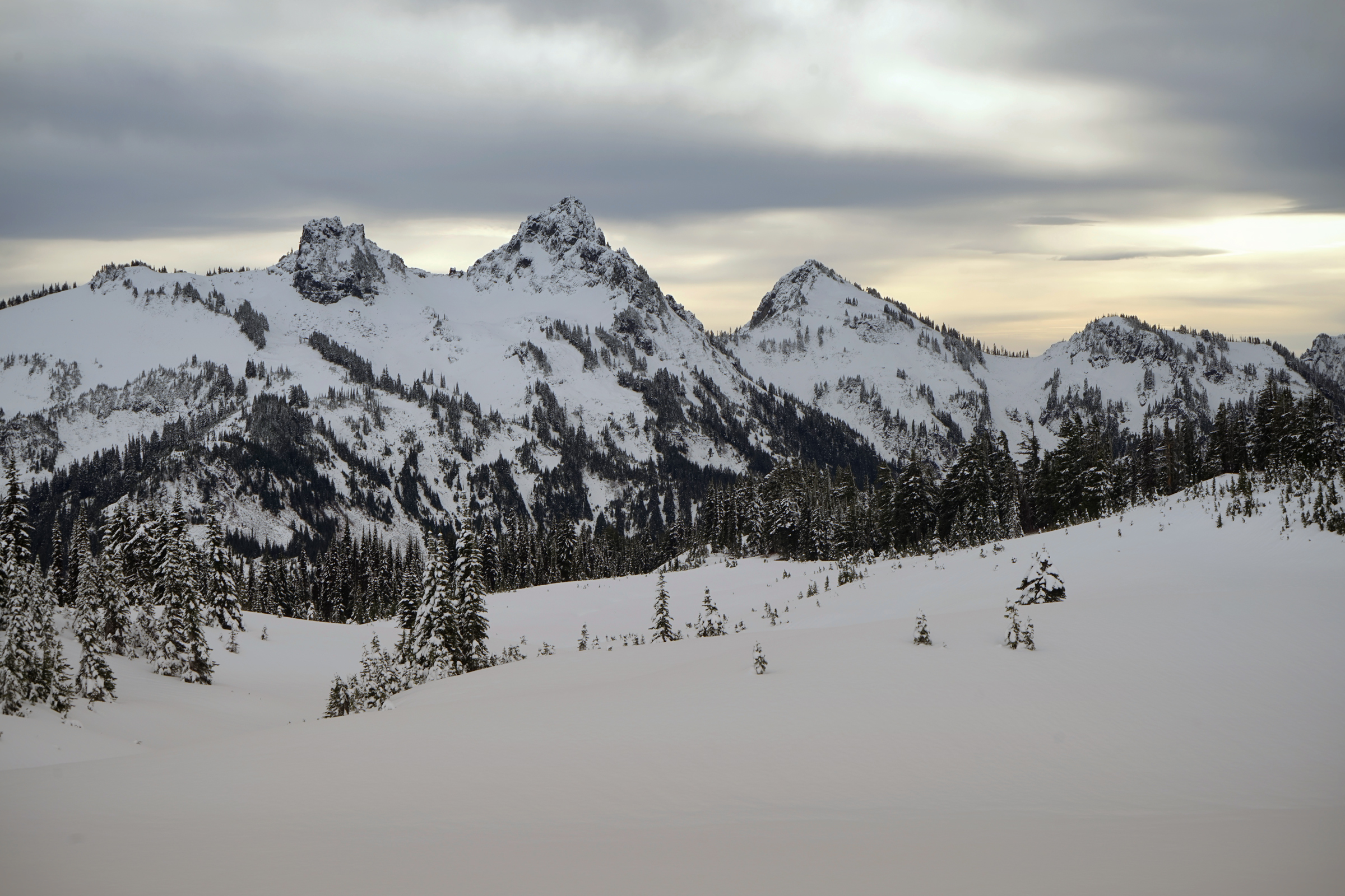
This section of the trail is broad and flat, and the views of Mt. Rainier to the north are awesome.
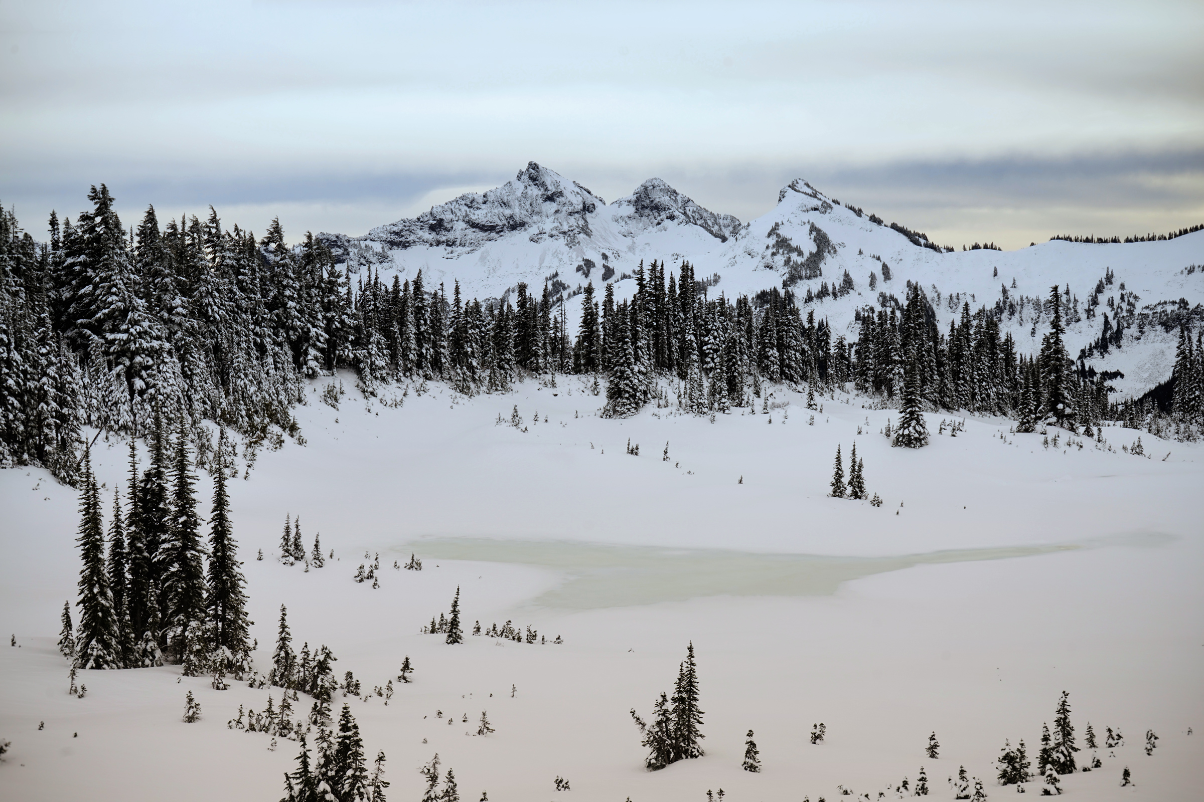
The Tatoosh Range, seemingly within throwing distance at Mazama Ridge
Mt. Rainier, from a broad, flat stretch of the Mazama Ridge
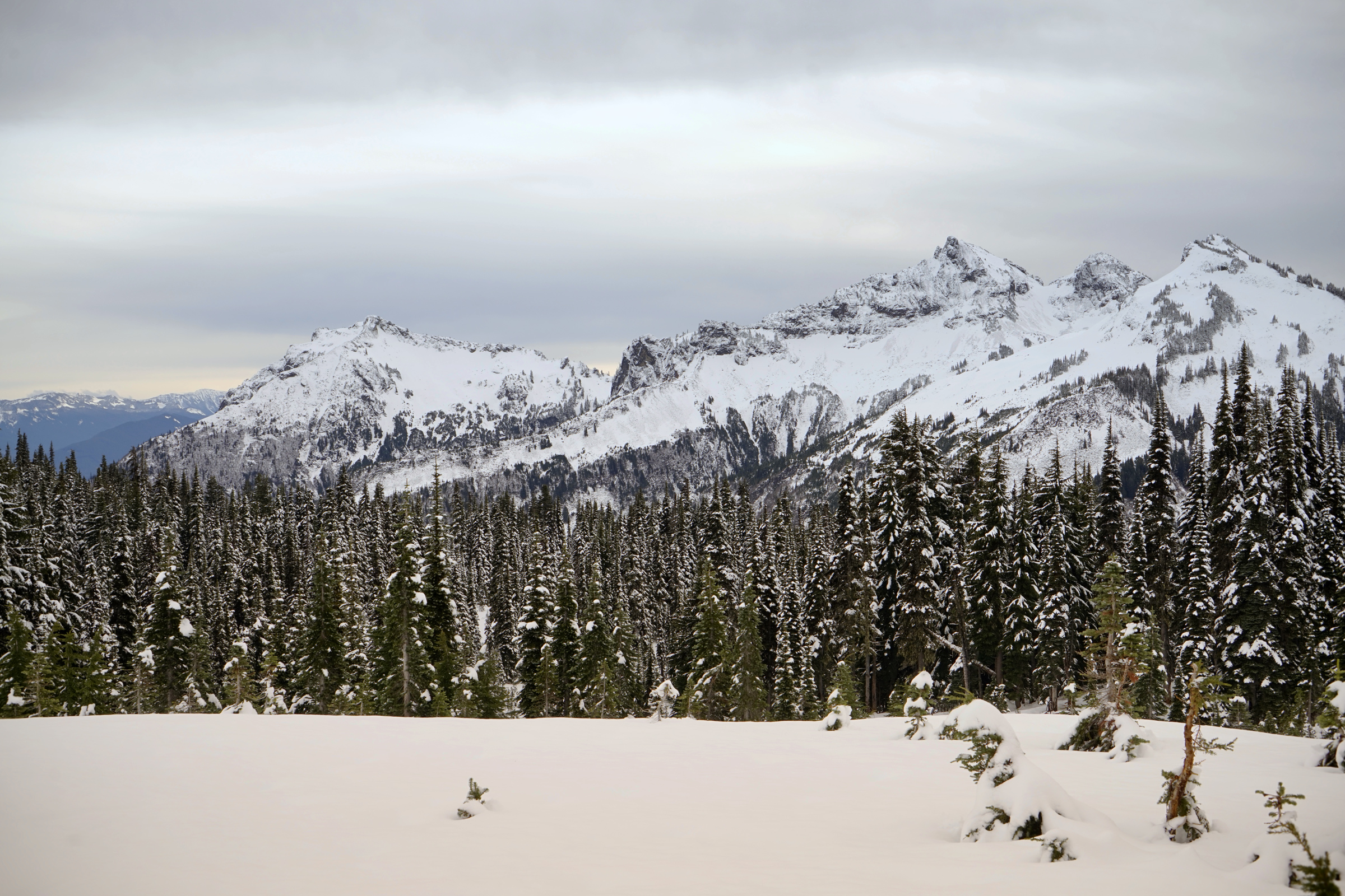
Looking east from the Mazama Ridge at the Tatoosh Range
Continuing south along the ridge, you will be losing elevation while staying east of the creek and waterfalls that feed the lower lakes, then proceed past the intersection with the High Lakes Trail.
The Mazama Ridge Trail drops sharply west just before Faraway Rock and crosses the creek at a lower elevation.
Immediately west of the creek, you will turn south to reach the road leading to Reflection Lakes, which is the lowest point of the loop at 4,900 ft.
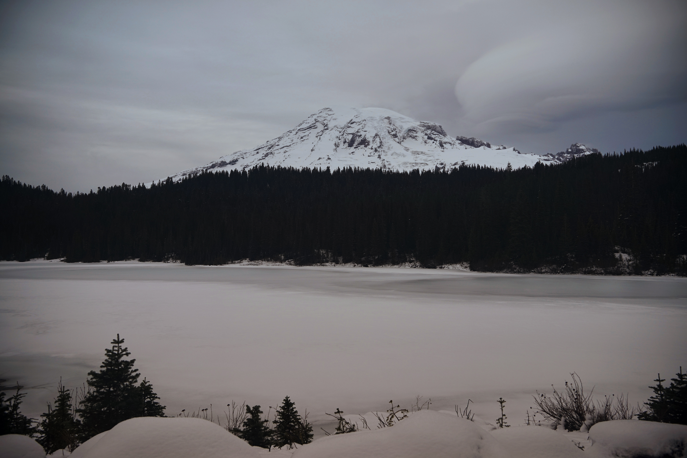
Reflection Lakes at nightfall
Head west along Stevens Canyon Road, and after passing Reflection Lakes, go north along the Lower Lakes Trail.
Eventually, you will cross a lower section of Paradise Road and continue the steep climb to reach the upper section of the road just east of the Paradise Visitor Center.
Directions
Park at the Paradise Visitor Center. Start by walking north on Paradise Road to the Fourth Crossing Trail.
1
Paradise Visitor Center: 46.785527, -121.733410
2
Fourth Crossing Trail: 46.790099, -121.726711
3
Mazama Ridge Trail: 46.790139, -121.719444
4
Mazama Ridge and High Lakes Trail: 46.775626, -121.720142
5
Reflection Lakes: 46.768936, -121.724235
6
Lower Lakes Trail: 46.769504, -121.733472
7
Lower Paradise Road: 46.776631, -121.736974

More Stories