Canada · August - September 2014
Banff and Jasper National Parks are two of the most stunning places I've ever traveled.
Just driving around, there are picture-perfect views of blue-green glacial lakes, dramatic mountain forms, and snowy peaks.
There are an infinite variety of hikes if you feel the need to wander deeper, and you can even take your dogs with you almost everywhere.
Banff and the Bow River Valley
The town of Banff has enough restaurants, lodging options, and activities to make this a good base for exploring the Bow Valley.
Canmore, located next to Banff, also makes a logical center for adventures in the area.
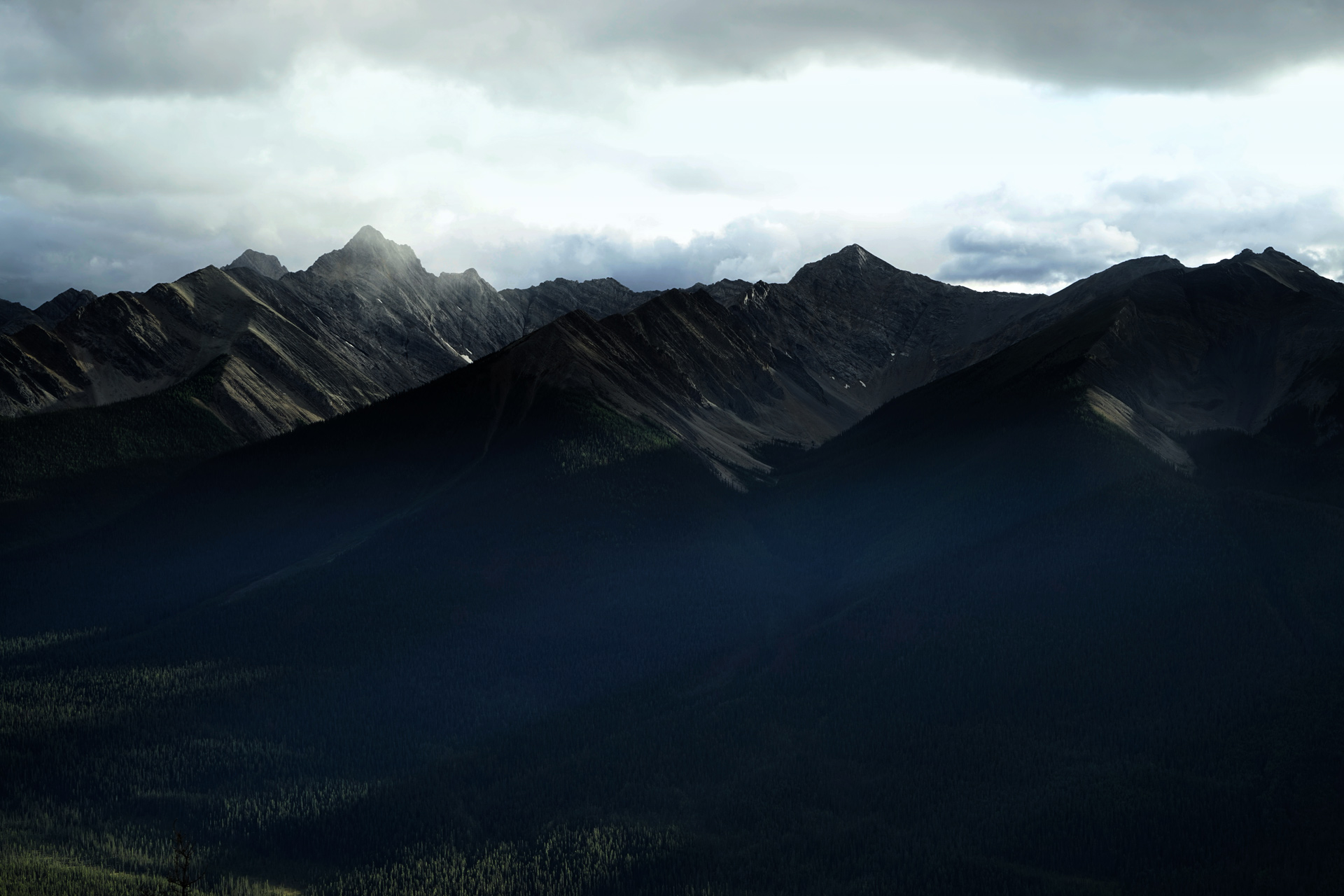
The outline of Mt. Rundle is easily the most recognizable feature next to Banff, and you can get some nice views of it from the Mt. Norquay ski area and Vermillion Lakes.
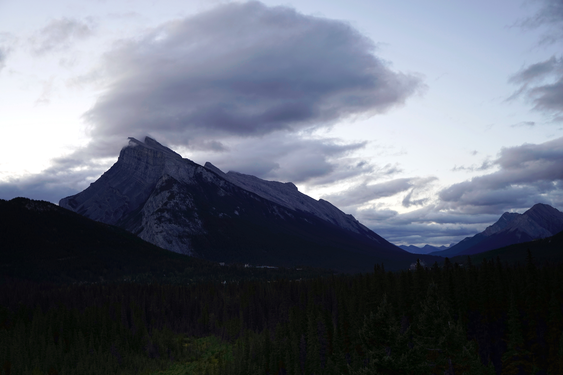
Mt. Rundle from the Juniper Hotel, next to the Mt. Norquay Ski Area: 51.187892, -115.588173
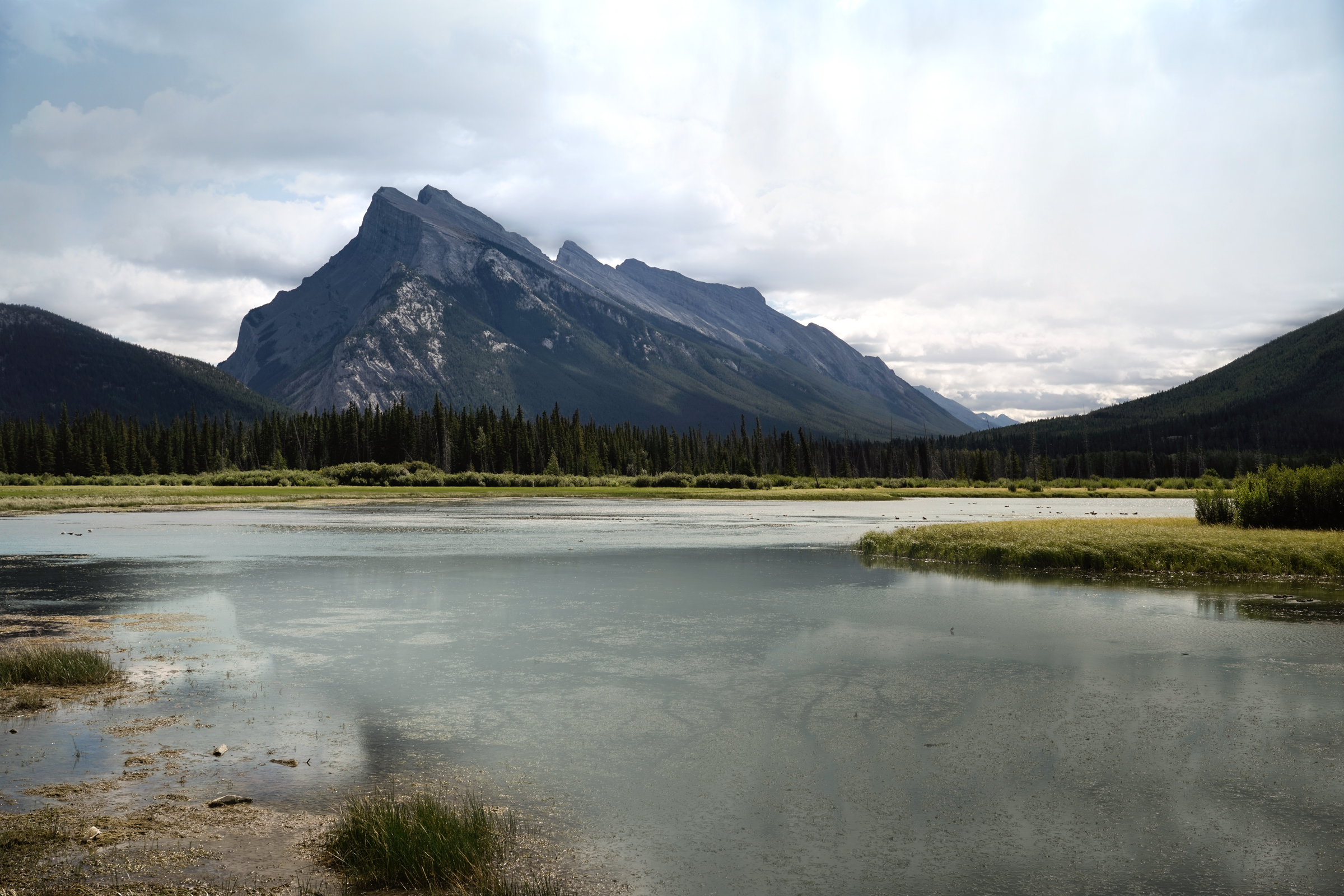
Vermillion Lakes: 51.181207, -115.605343
On the north side of Mt. Rundle, just east of the Tunnel Mountain Campground, there are hoodoos along the Bow River.
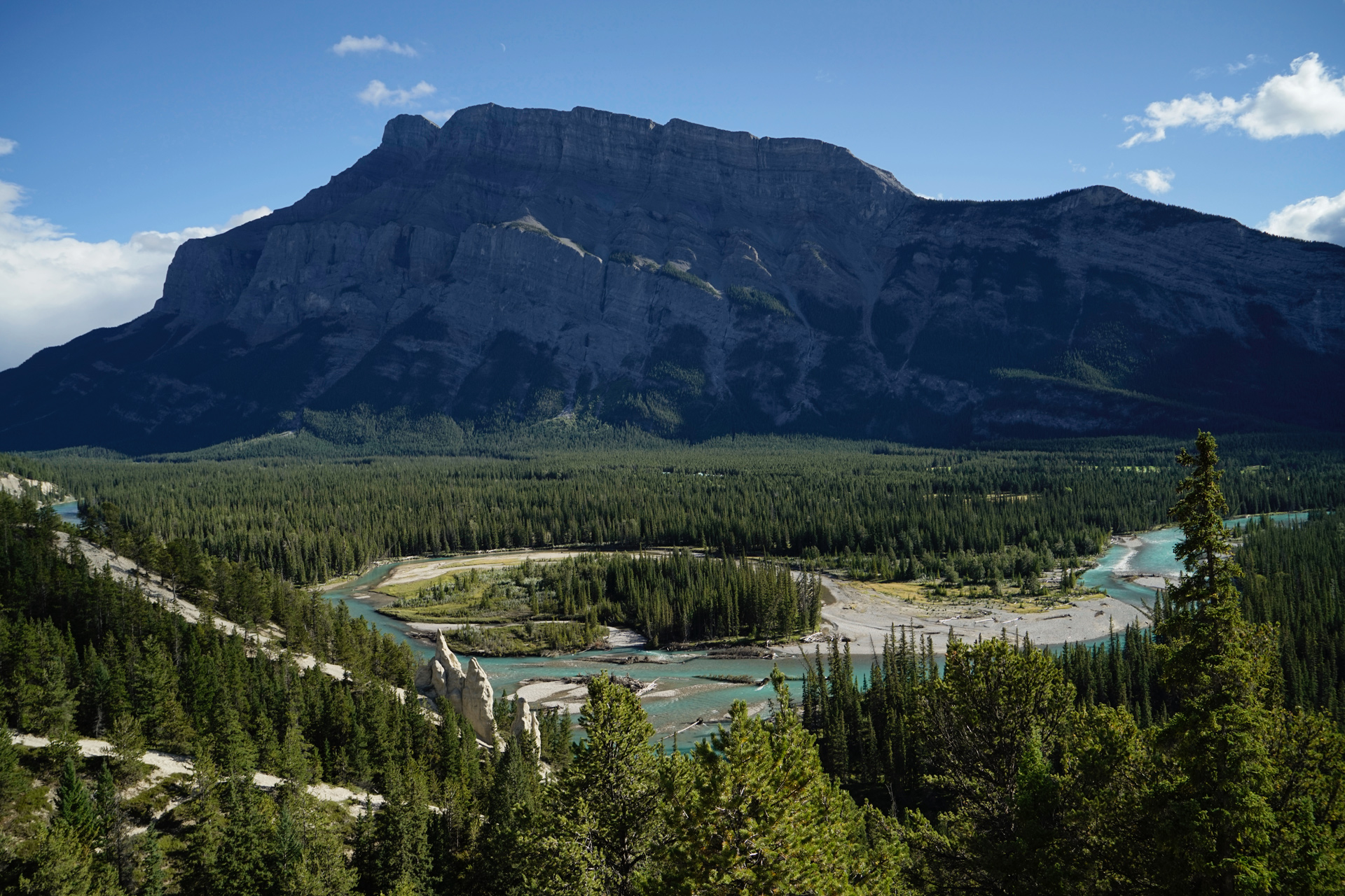
Hoodoos, Bow River, and Mt. Rundle: 51.189661,-115.530278
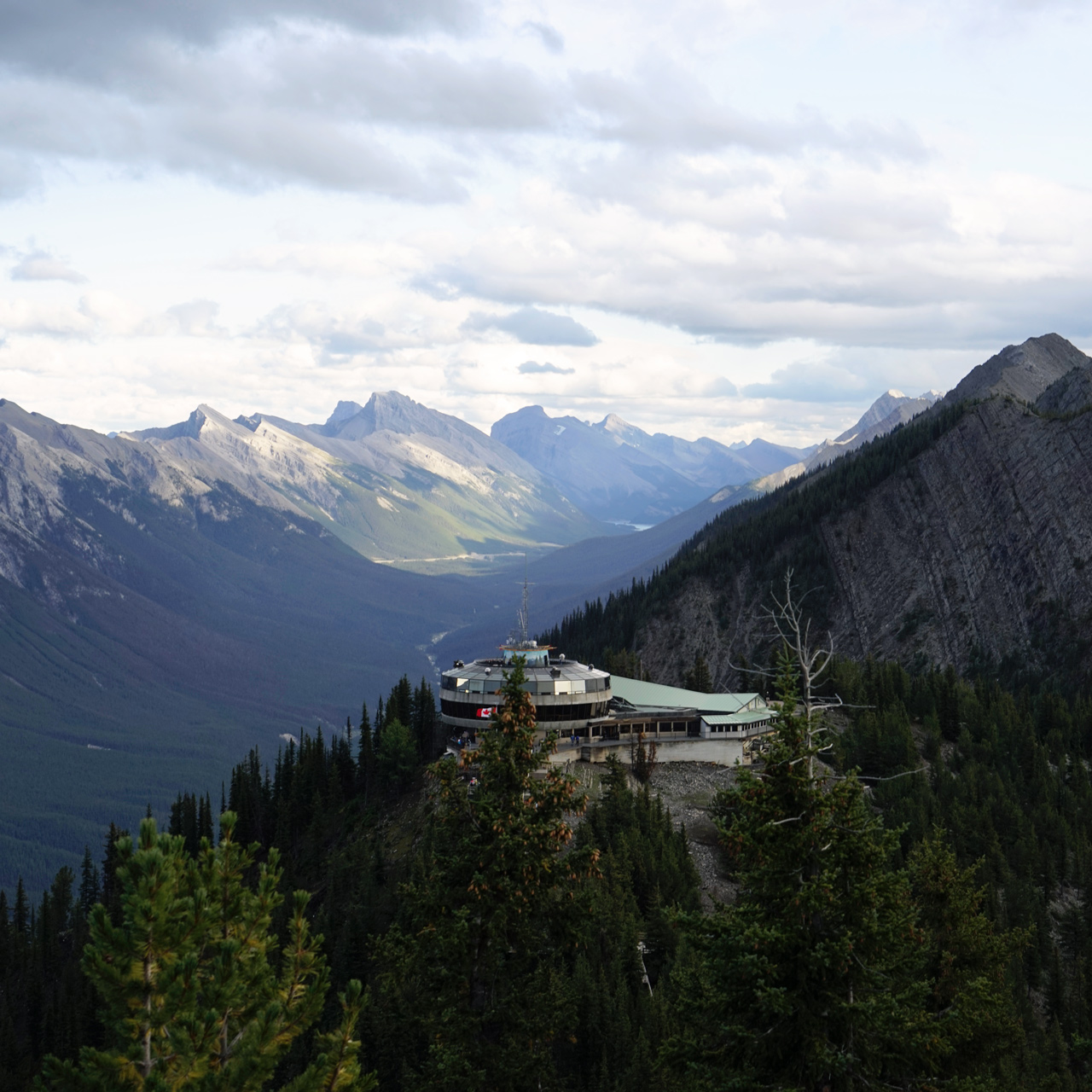
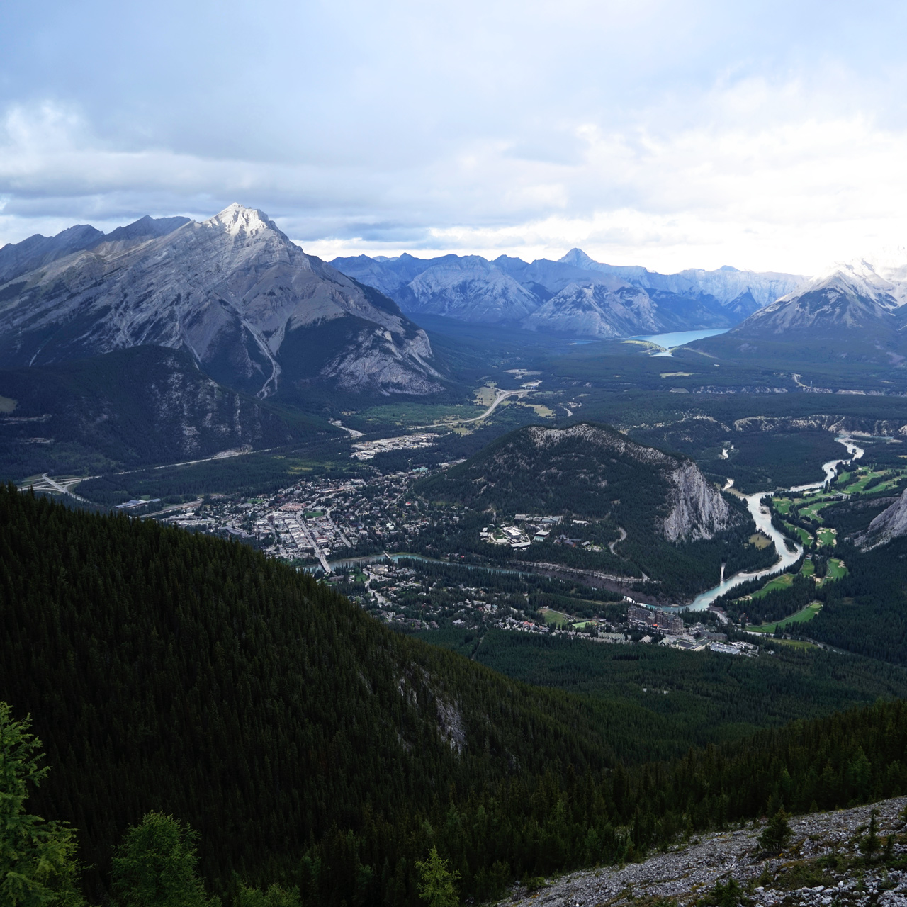
At the south edge of town, past the Fairmont Banff Springs, there is a gondola that takes you to the top of Sulphur Mountain for more incredible mountain views.
Looking west, you'll see the peaks of the Sundance Range.
Hiking the C-Level Cirque
5 miles out and back, 1,500 feet vertical gain
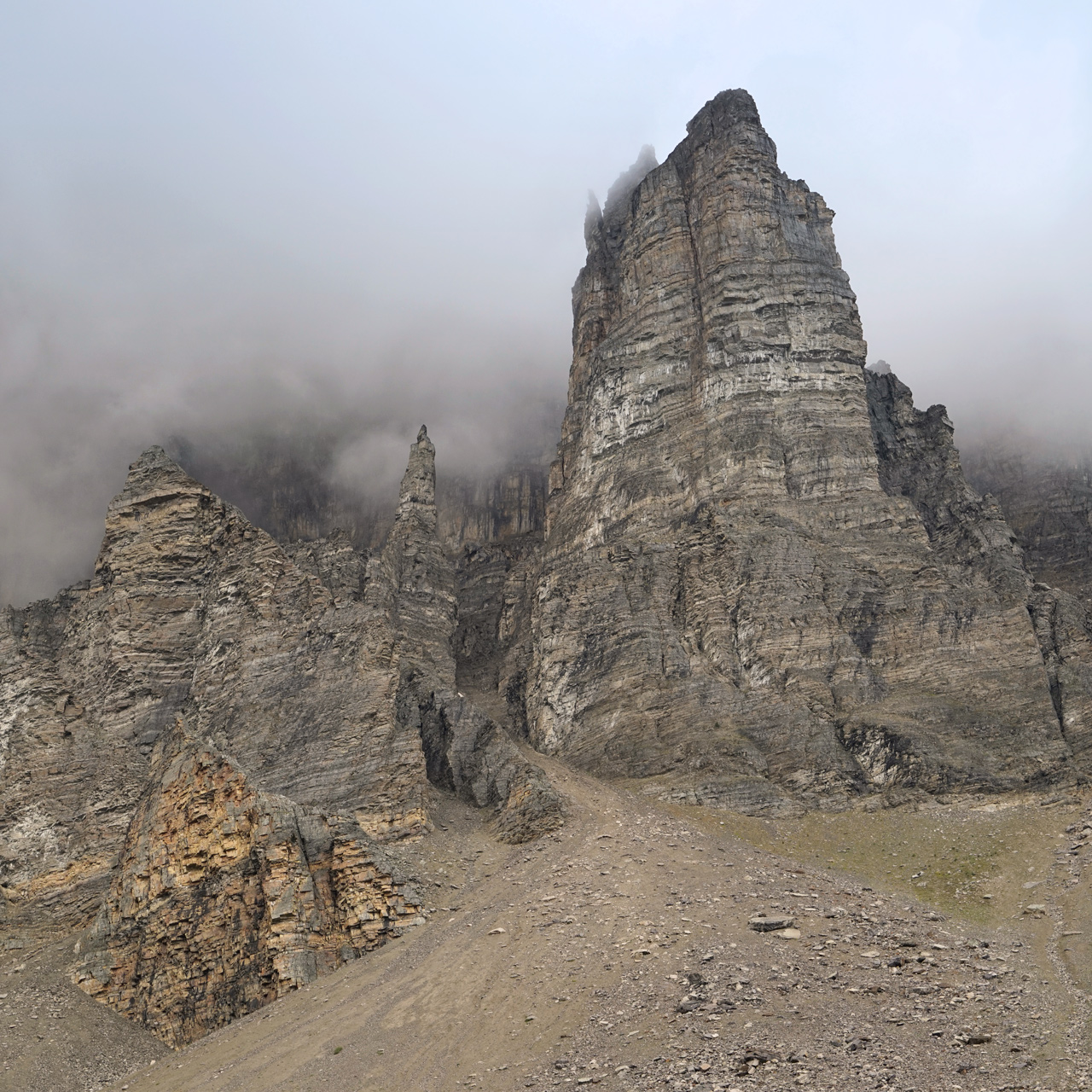
Cascade Mountain, looming large over Banff, was once mined for its high quality anthracite coal deposits.
There were three vertical stages of the Bankhead Mine, and the C-Level-Cirque was its highest.
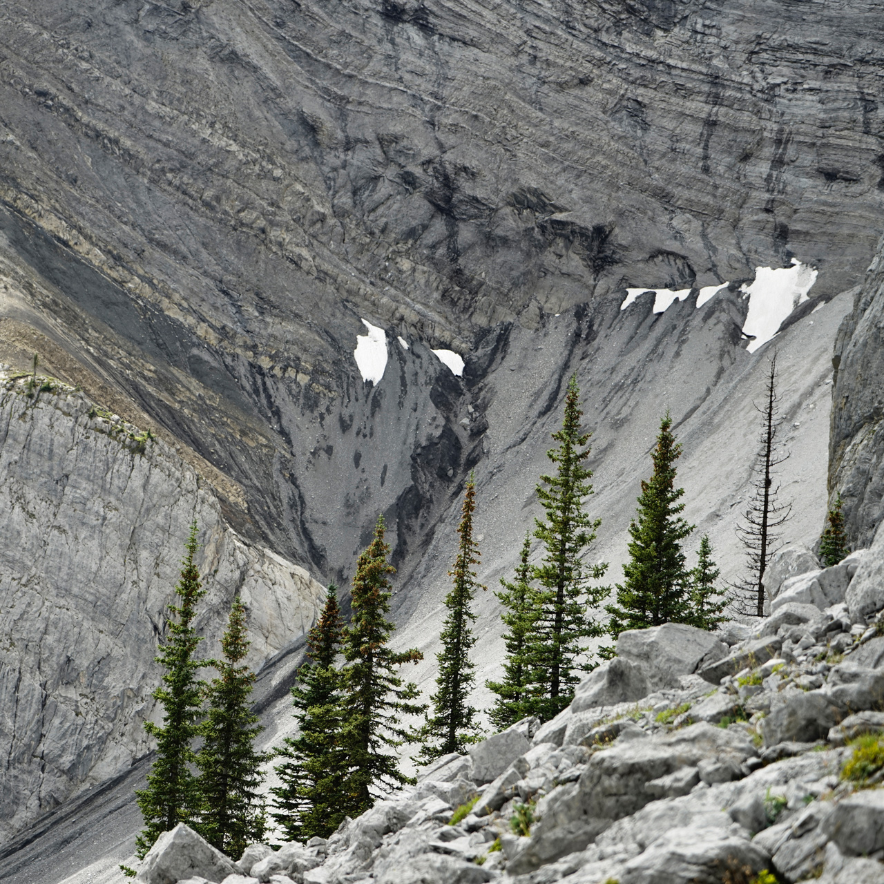
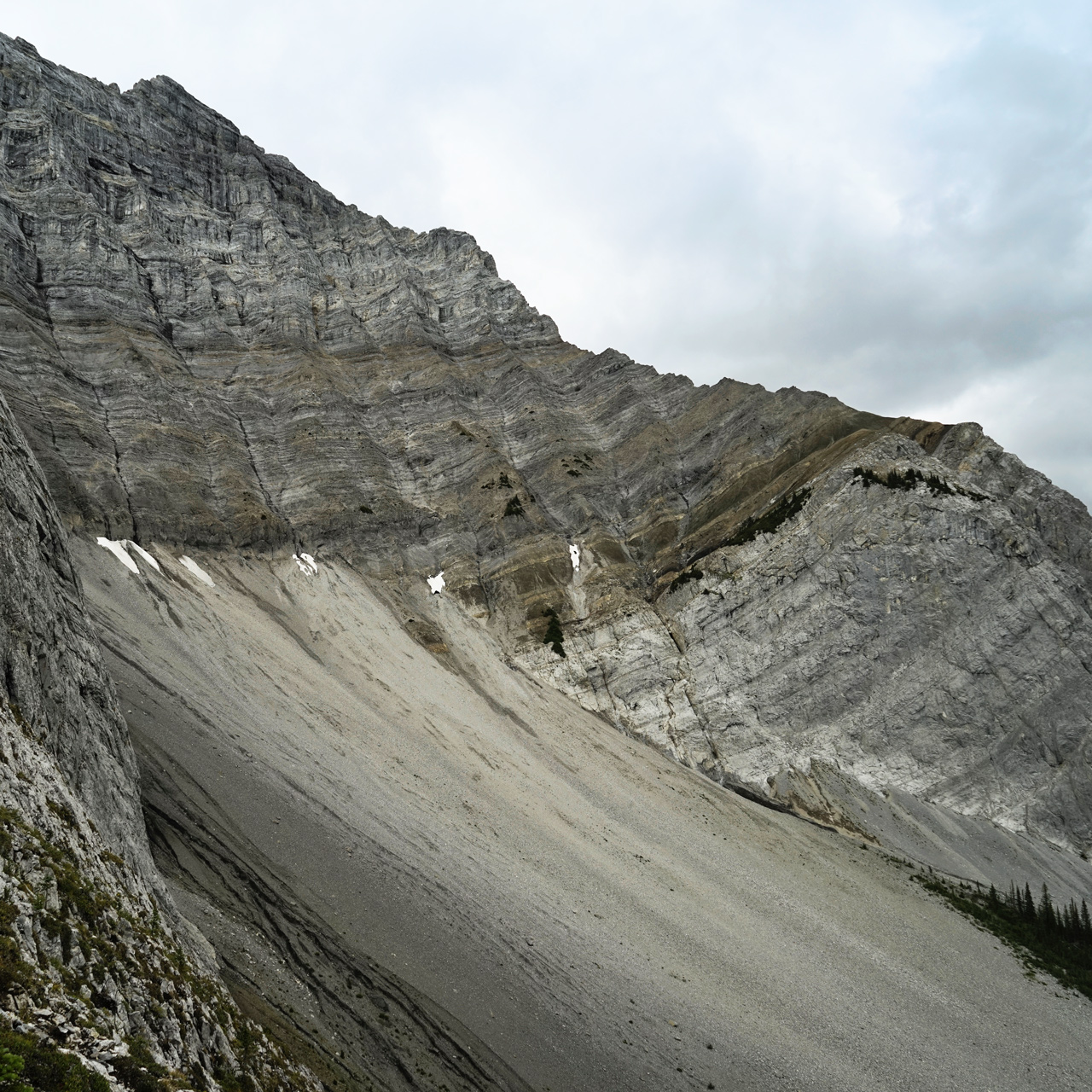
At this level, a stark landscape of gray boulders and a few green trees become a stage for excellent views of Lake Minnewanka.
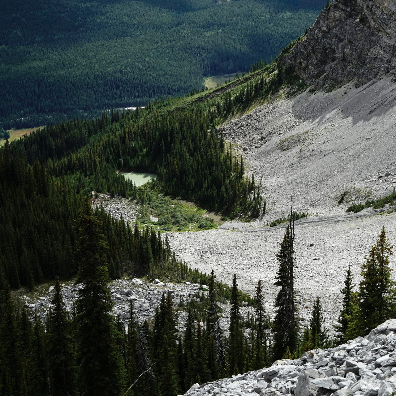
The hike starts by marching through the dense forest at the base of Cascade Mountain, and the trail takes you past some of the ventilation shafts of the lower mines.
You pop out of the trees only after gaining some significant elevation.
Eventually, you will reach a small pond with views opening upward to the steep slopes of the upper mountain.
From here to the top, there are some sections of loose rock you may have to scramble up.
I could not make out a clear end point, but the views toward Lake Minnewanka get better the higher you go.
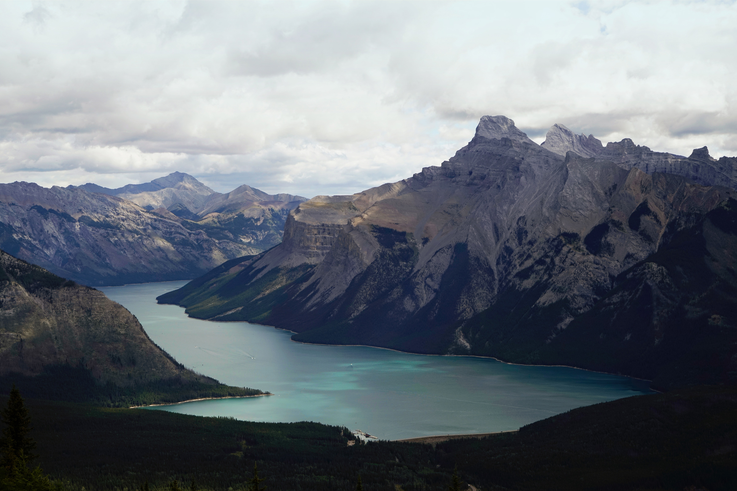
Lake Minnewanka and Mt Girouard from the C-Level Cirque: 51.241549, -115.545217
The trailhead is located at the Lake Minnewanka Upper Bankhead Parking Lot and Picnic Area: 51.236812, -115.519753
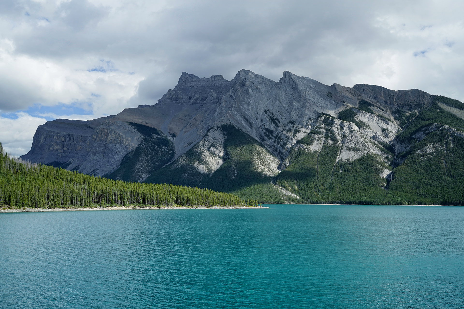
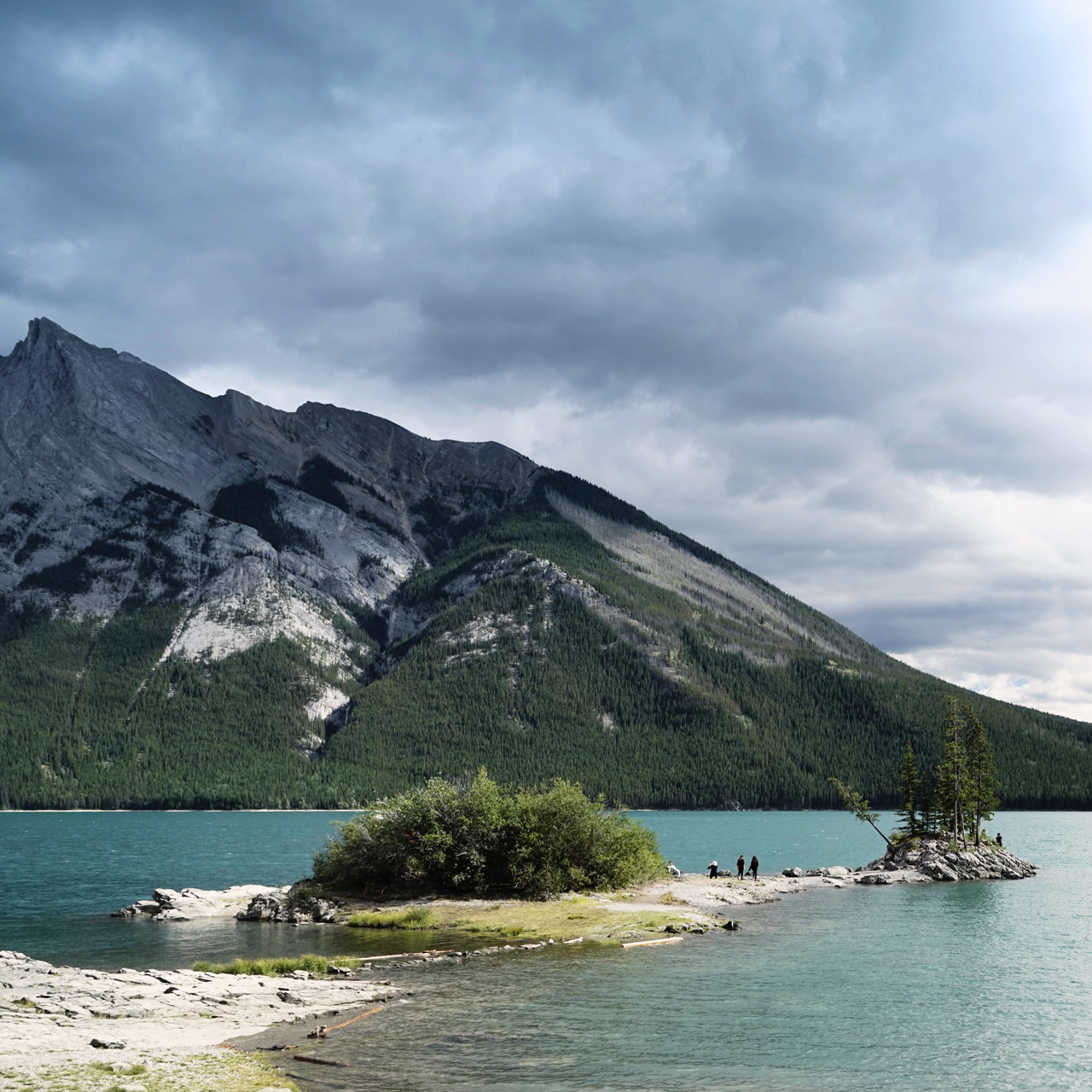
Lake Minnewanka
Lake Minnewanka is not far from Cascade Mountain.
Although it is one of the most popular destinations in Banff, most people only experience a small section its western edge.
The Fairholme Range is set against the opposite shoreline, and cruises of the lake can take you to The Devil's Gap at the east end of the lake.
A walk to the Stewart Canyon Bridge is another way to soak in the views.
Dogs are allowed on the trail up to the bridge, which is a little more than 1.5 miles round-trip from the parking area.
Apparently, it is not uncommon to see bears deeper into Stewart Canyon.
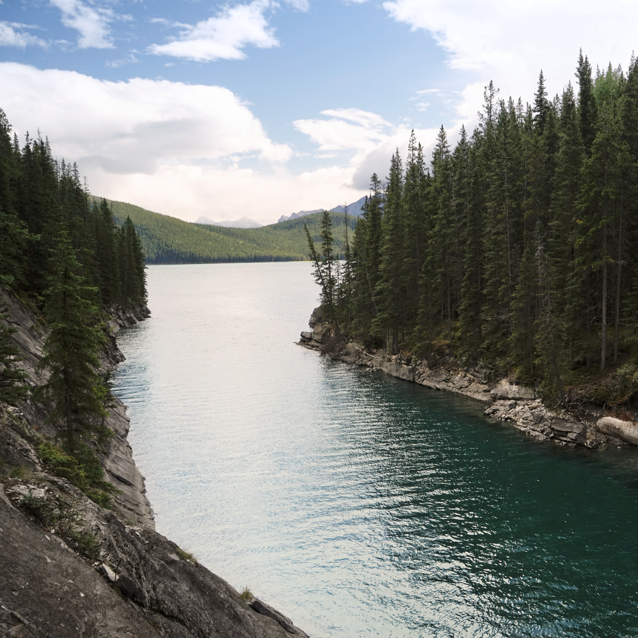
The parking area is at the west end of Lake Minnewanka: 51.247833, -115.500146
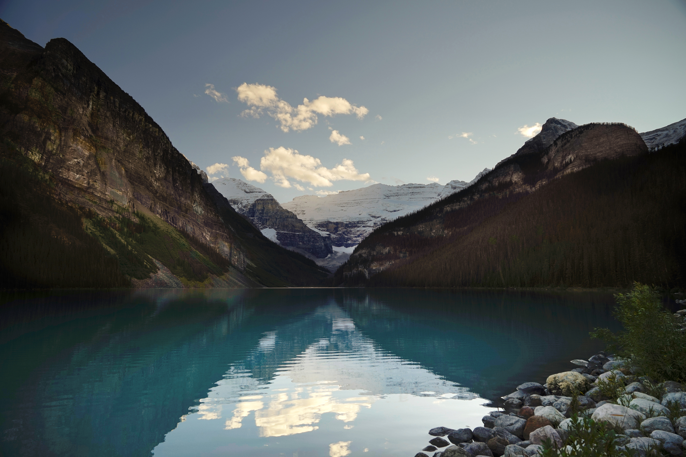
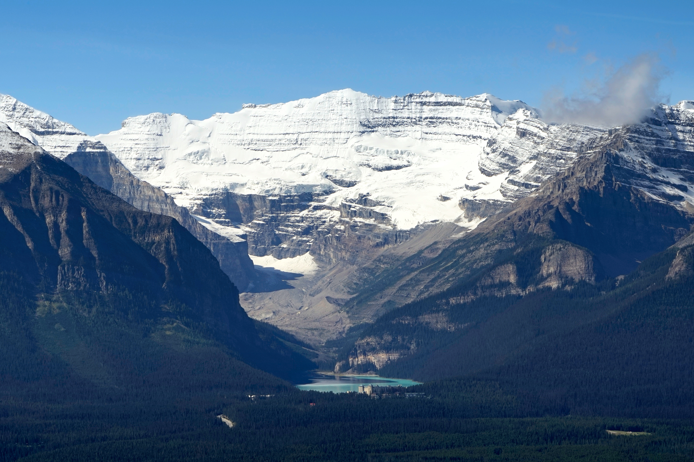
Lake Louise
Connecting Banff to the Lake Louise area are the Trans-Canada Highway and the Bow Valley Parkway.
The highway is generally faster and has open views of the surrounding mountains, but there are more places you can pull over to enjoy the scenery on the Alberta 1-A.
One of the best views along the Bow Valley Parkway is at Morant's Curve, a short distance east of Lake Louise.
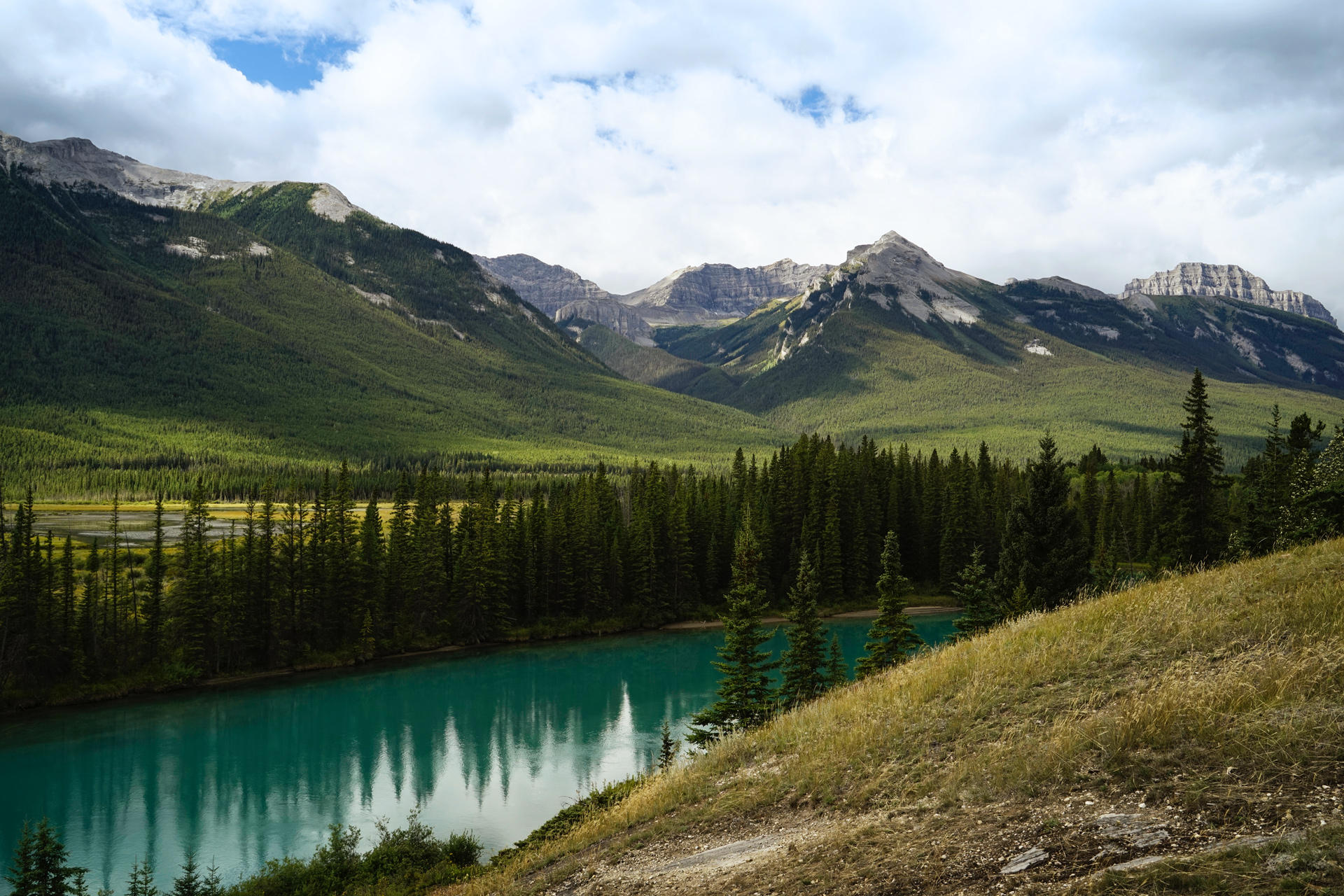
Morant's Curve: 51.399627, -116.128621
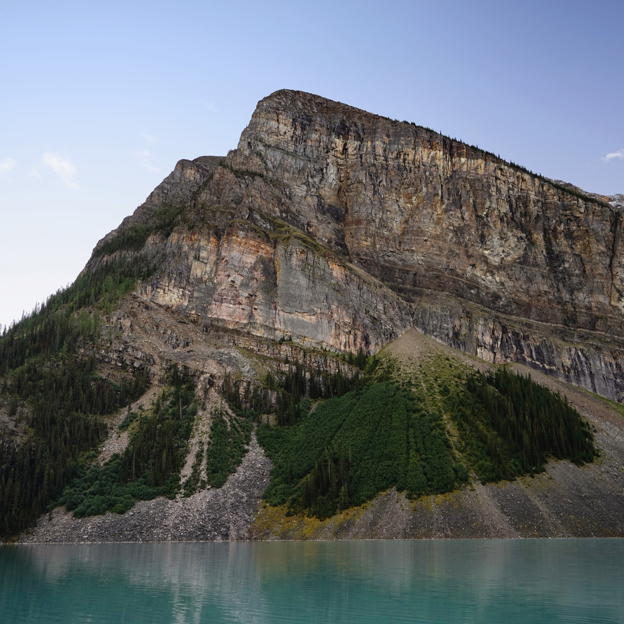
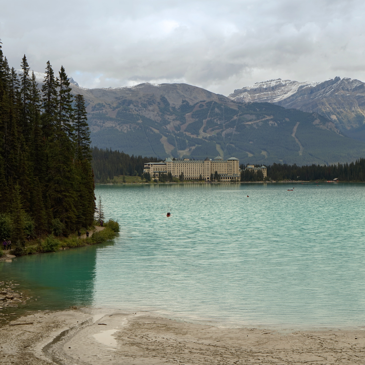
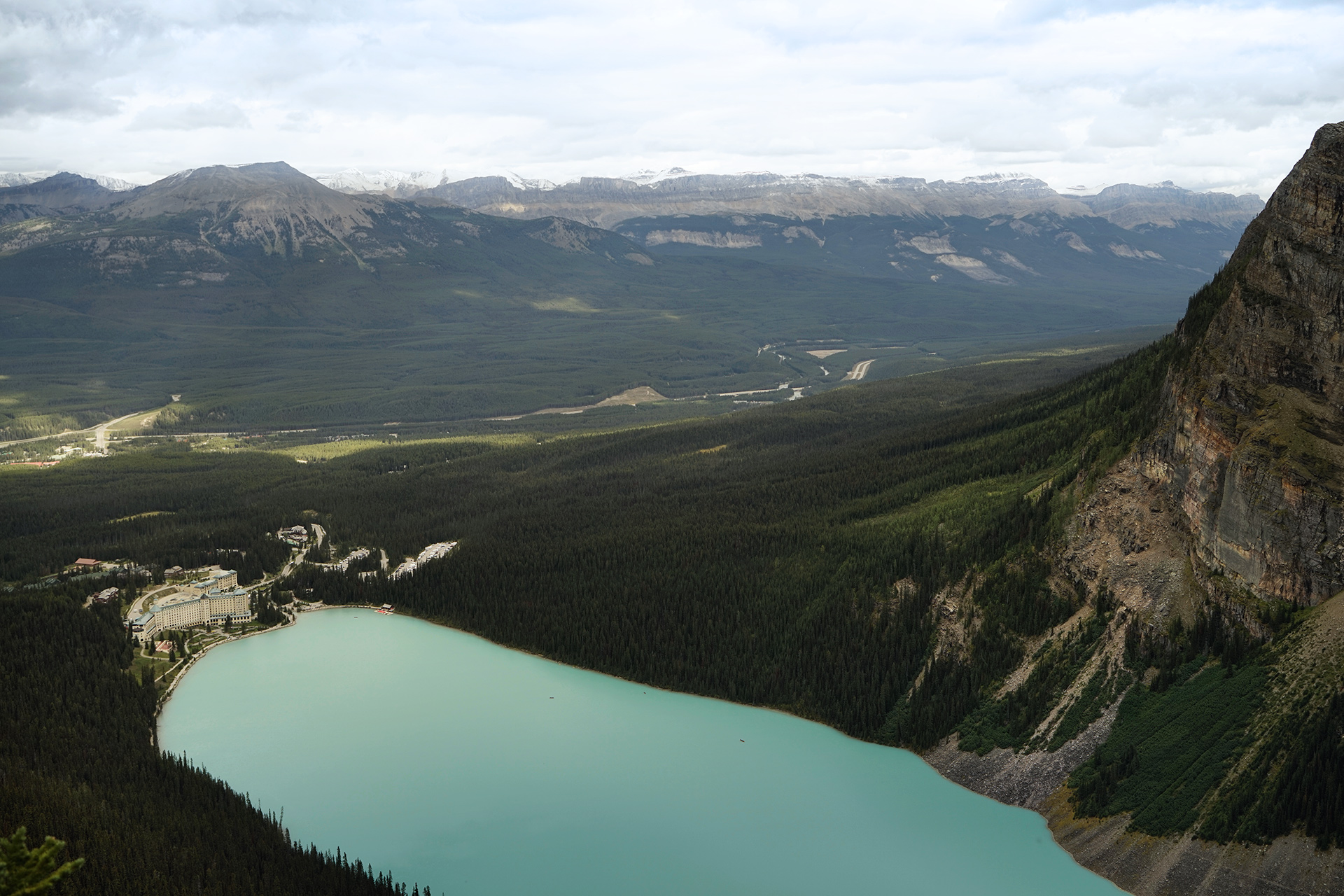
Situated directly on the northeast bank of Lake Louise is The Fairmont Chateau, one of the nicest hotels I've ever stayed.
There are some great hikes that start at the hotel, and even if your legs are not feeling strong, you can take a flat walk to the far end of the lake or rent a canoe.
For another perspective of Lake Louise, there is a ski area across the highway, where you can take a lift in the summer or winter. I was told there are daily grizzly bear sightings from the gondola.
A view from the Lake Louise Ski Resort: 51.441780, -116.162697
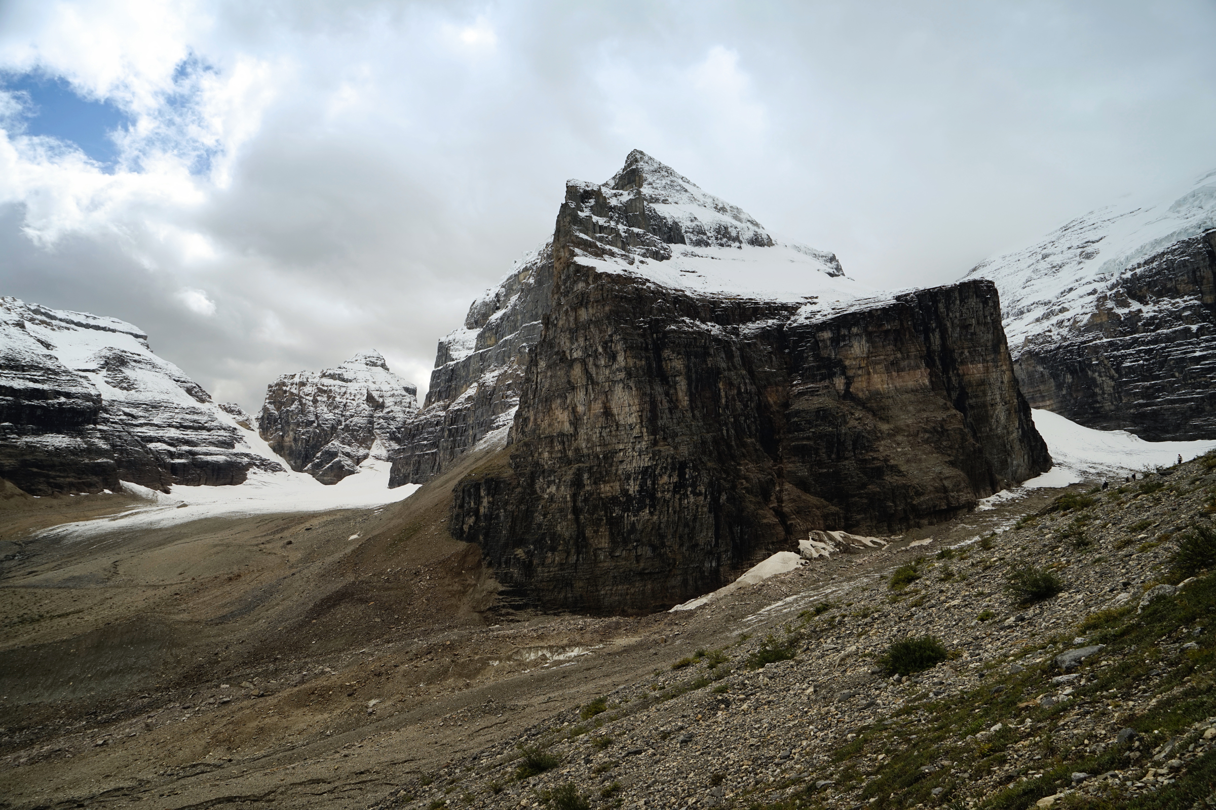
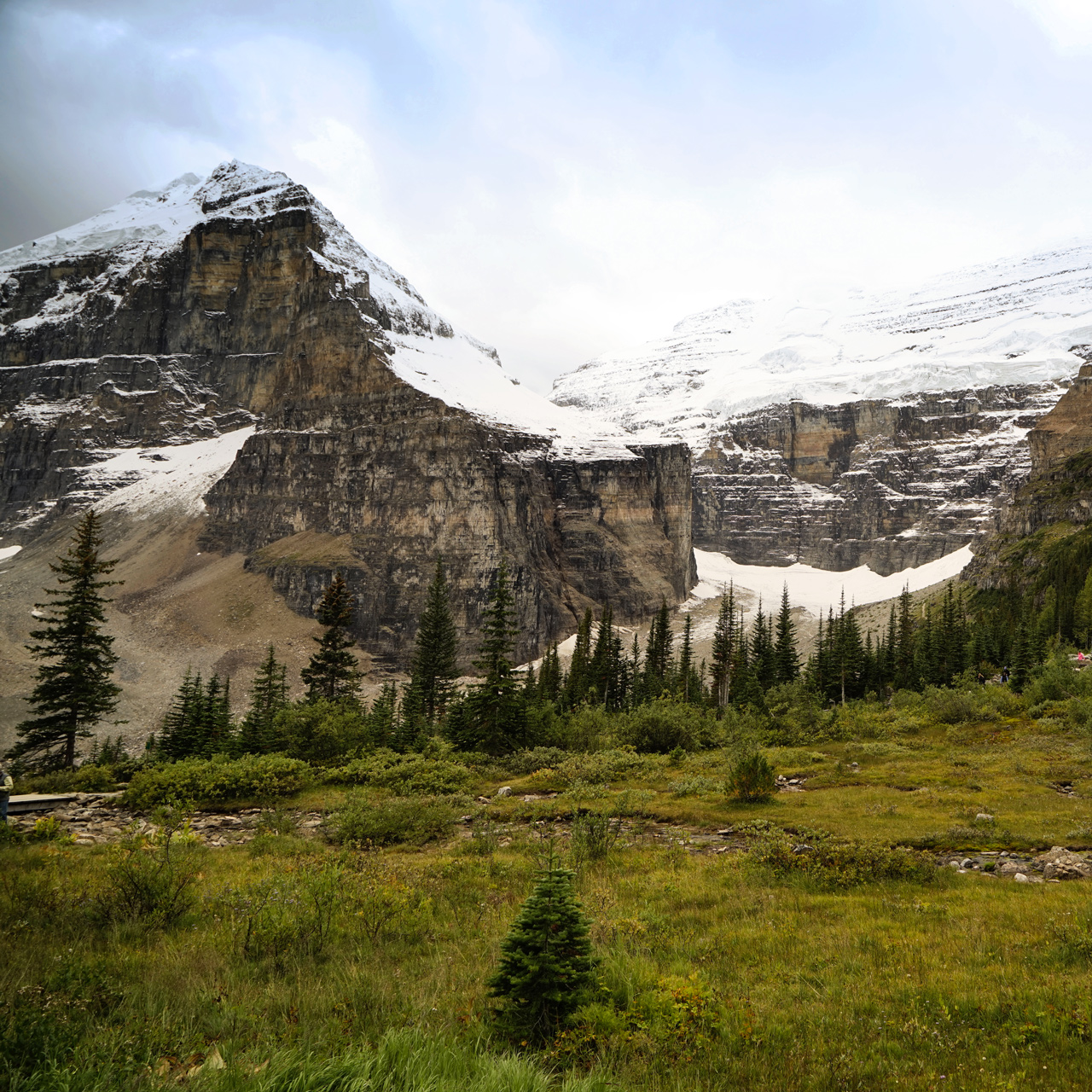
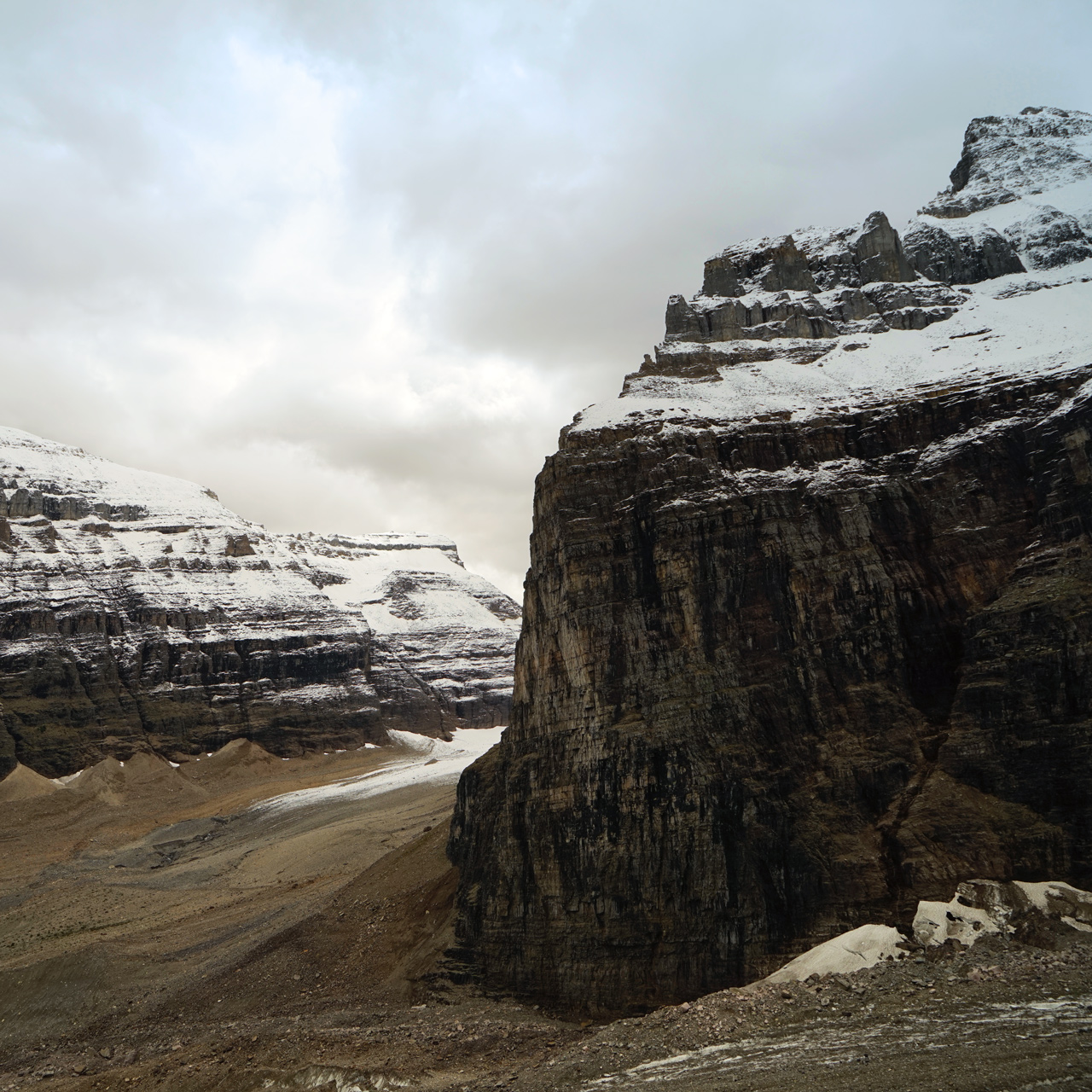
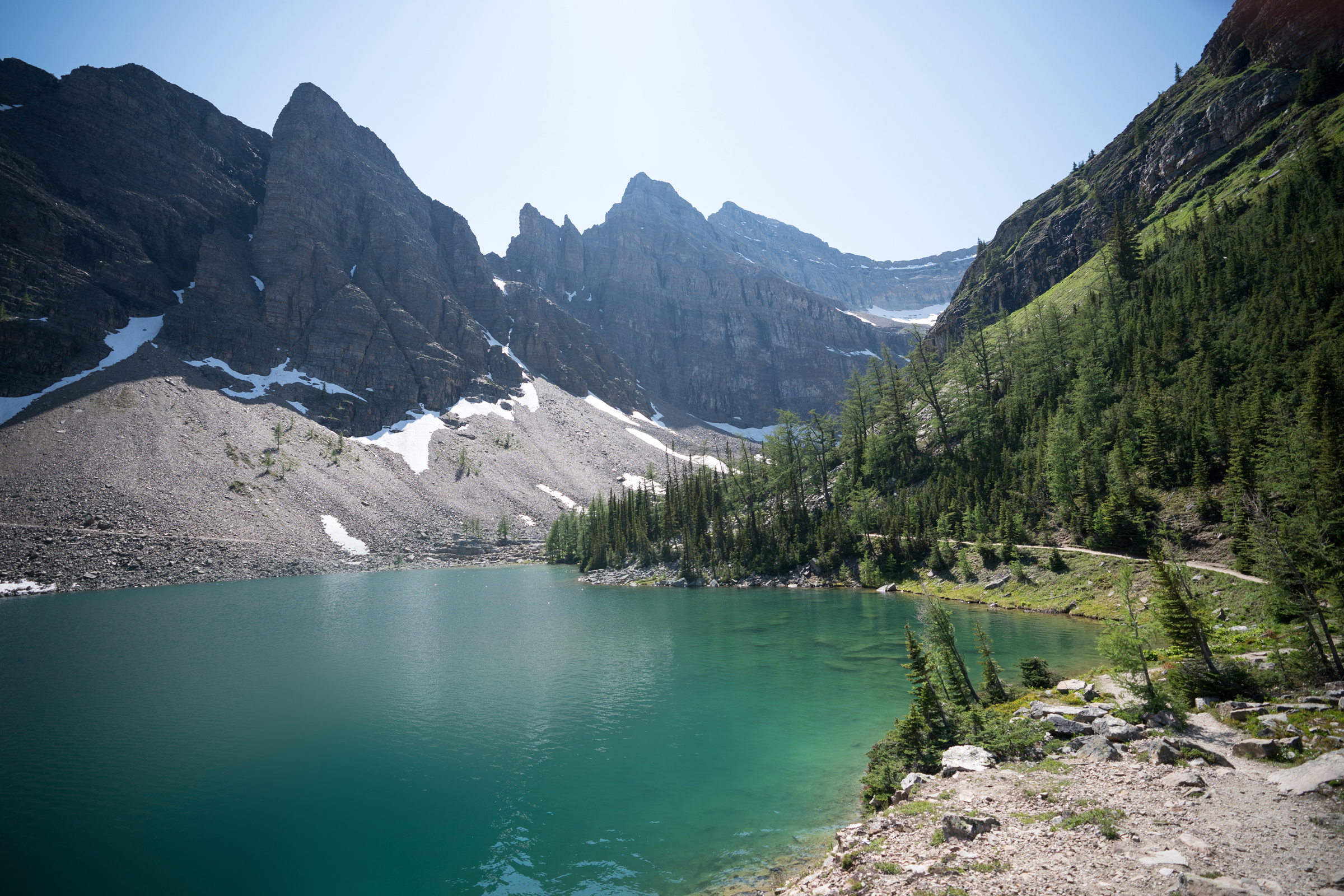
Hiking the Plain of Six Glaciers and Lake Agnes Teahouse
11 miles loop, 3,100 feet vertical gain
One of the best hiking experiences I've ever had was completing something known as the "Tea House Challenge."
This involved a strenuous walk up to the two tea houses in the mountains above Lake Louise in a single day.
Although, the Lake Agnes Teahouse is the more popular of the two and the one closer to The Fairmont Chateau, I decided to visit the Plain of Six Glaciers first.
I wanted to avoid the crowds, and I had heard that this section of the hike had better scenery.
Going past the far end of Lake Louise, you will see the Victoria Glacier up close, chiseled rock shapes, and end up in an amazing high meadow where the tea house is situated.
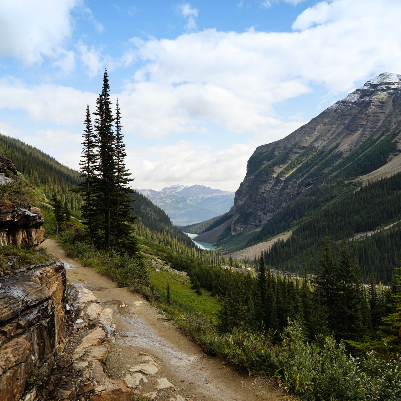
After lunch, I took the Highline Trail and a detour to the top of the Big Beehive to see Lake Louise from above.
From there, it is a steep drop away from Lake Louise and down to Lake Agnes, where you can see the Tea House at the far end.
The trail to the Plain of Six Glaciers and the Lake Agnes Tea House starts at The Fairmont Chateau at Lake Louise: 51.417335, -116.214977
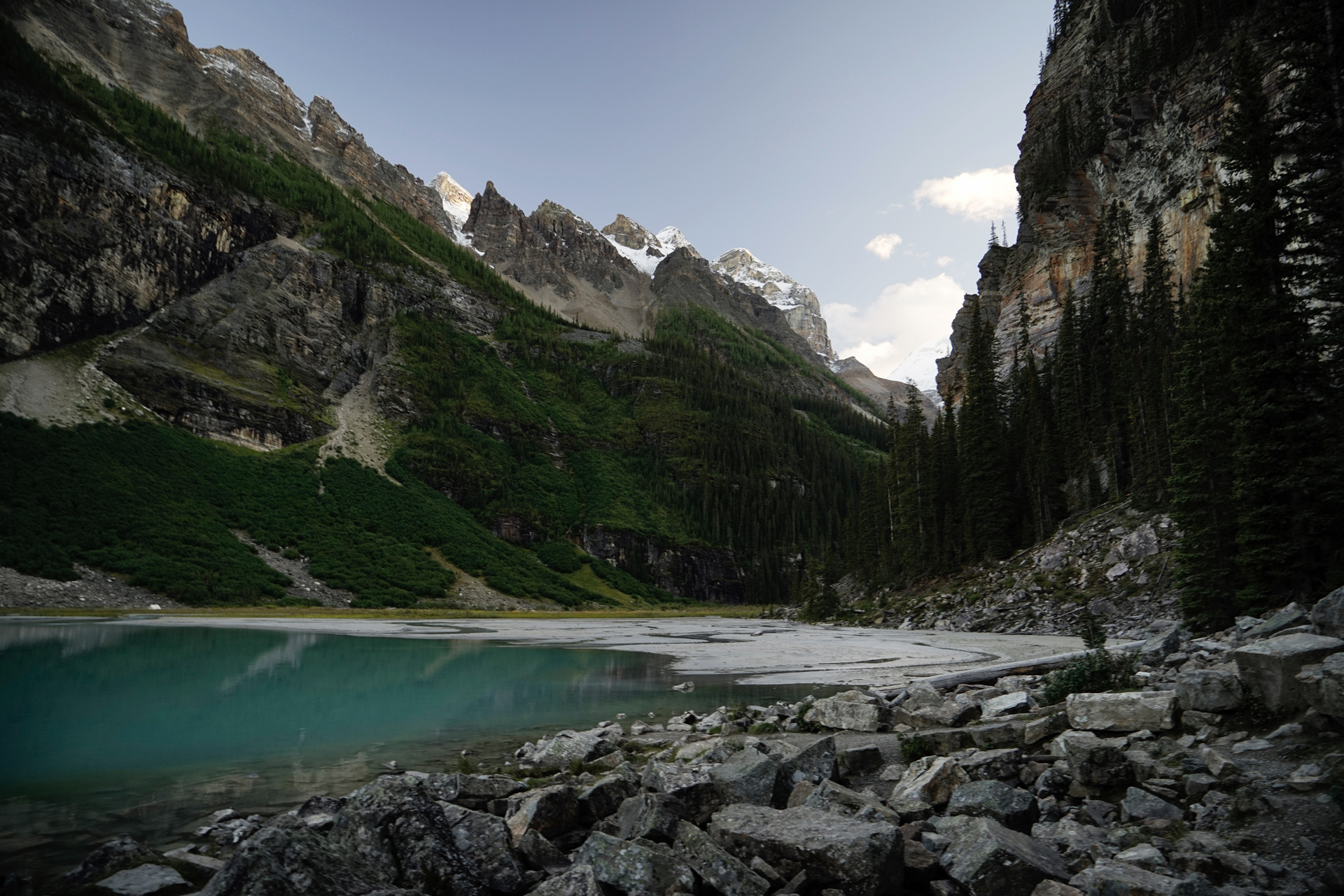
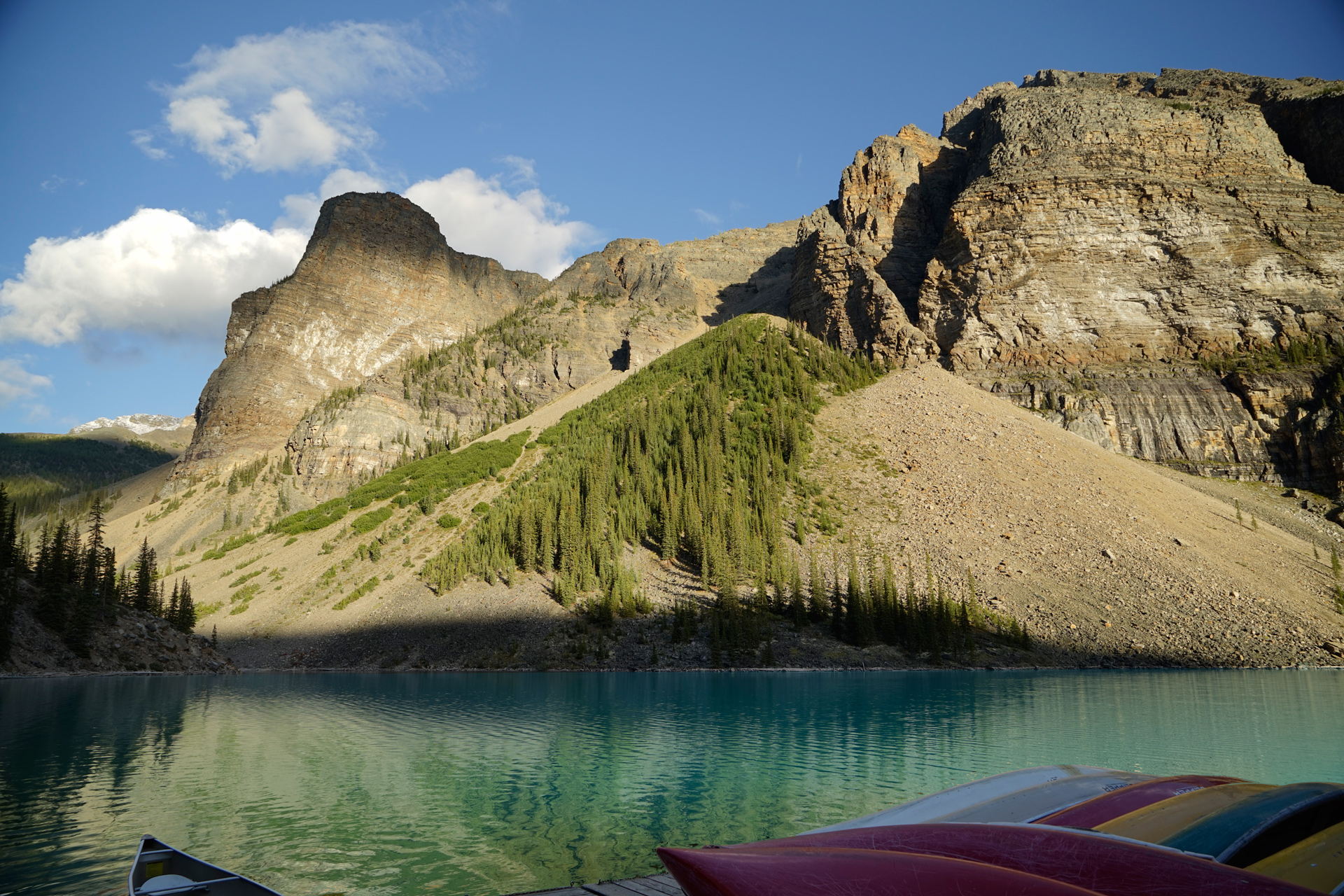
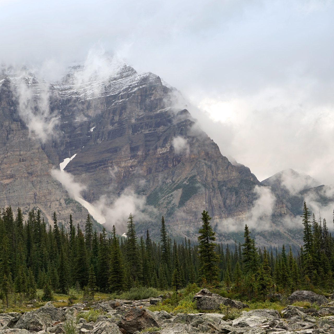
Moraine Lake
Moraine Lake, one of the most photographed places in the Canadian Rockies, is a short distance south of Lake Louise.
Its blue-green color comes from the way light bounces off the glacial rock flour in the water.
Next to the lodge at the north end of the lake is a rock pile with a paved path to a few viewpoints toward the Valley of Ten Peaks.

The Moraine Lake Lodge has a parking area located next to the lake: 51.330451, -116.180822
Hiking Consolation Lakes
4.5 miles out and back, 500 feet vertical gain
The hike to Consolation Lakes starts from Moraine Lake.
There are bears in the area, so this requires that you hike in a group of 3 or more people and keep your dogs on leash.
Once you round the base of the Tower of Babel at the beginning of the hike, the trail proceeds more or less straight southeast to Upper Consolation Lake.
The floating glacier of Mount Quadra is visible from here, but you can also hop across a bunch of boulders to reach Lower Consolation Lake for a better view.
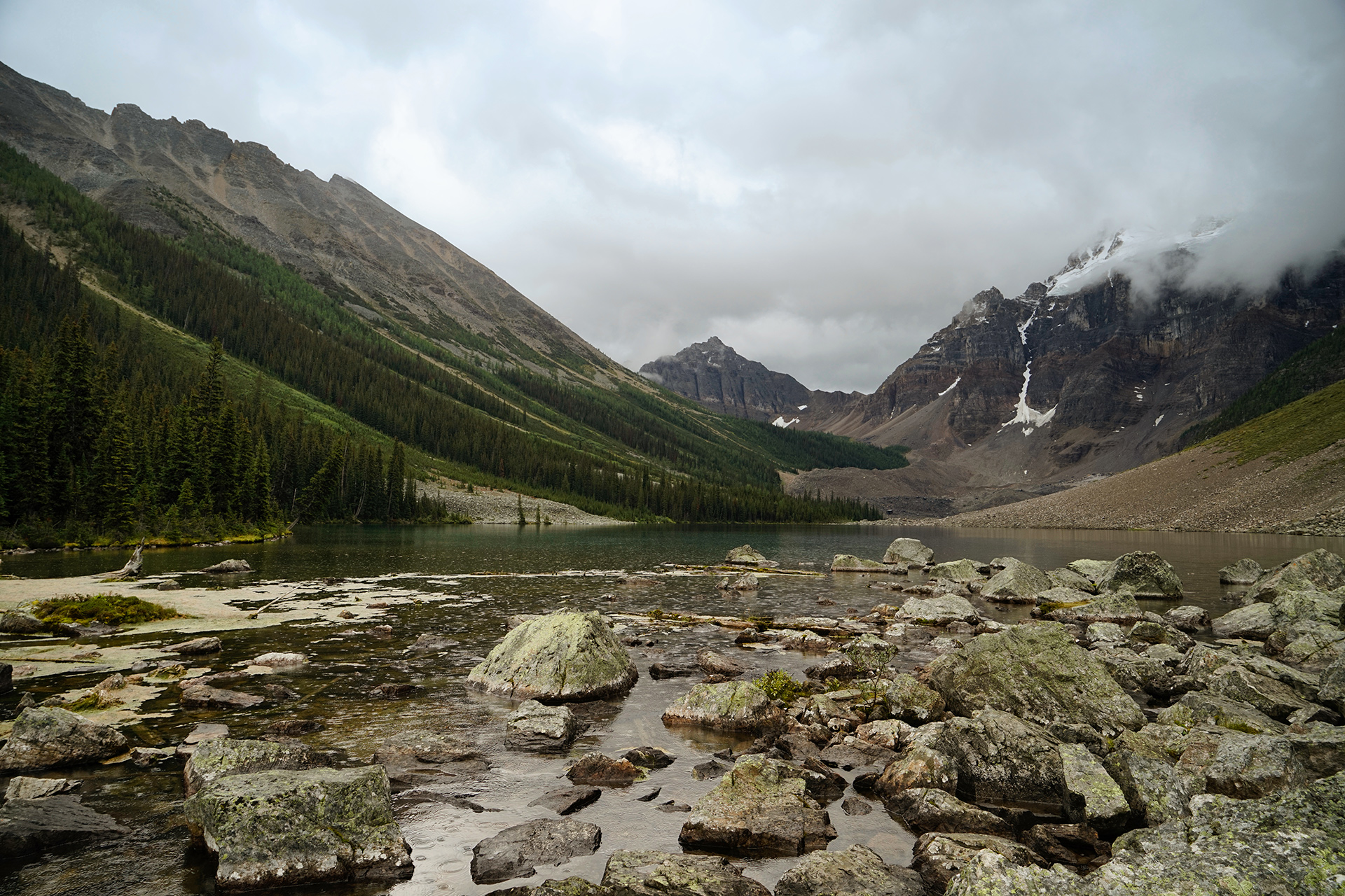
The trailhead is located next to the large rockpile at the north end of Moraine Lake: 51.328071, -116.181384
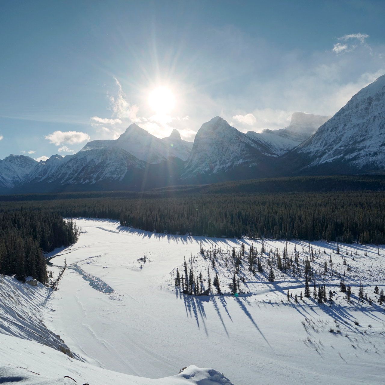
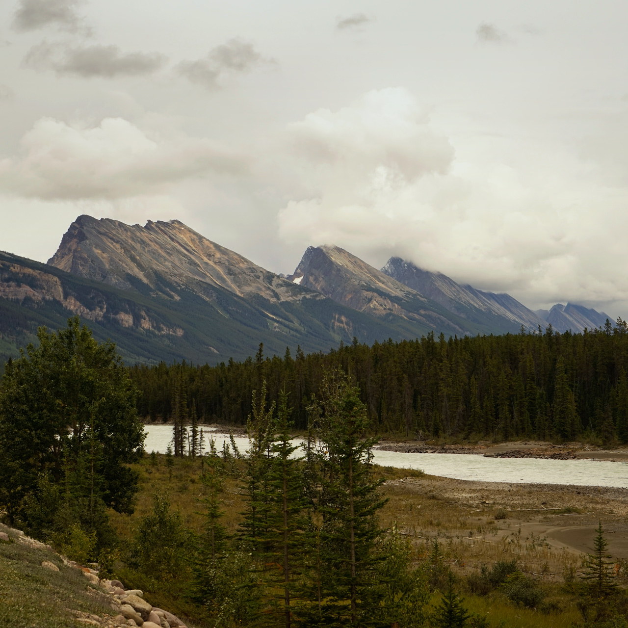
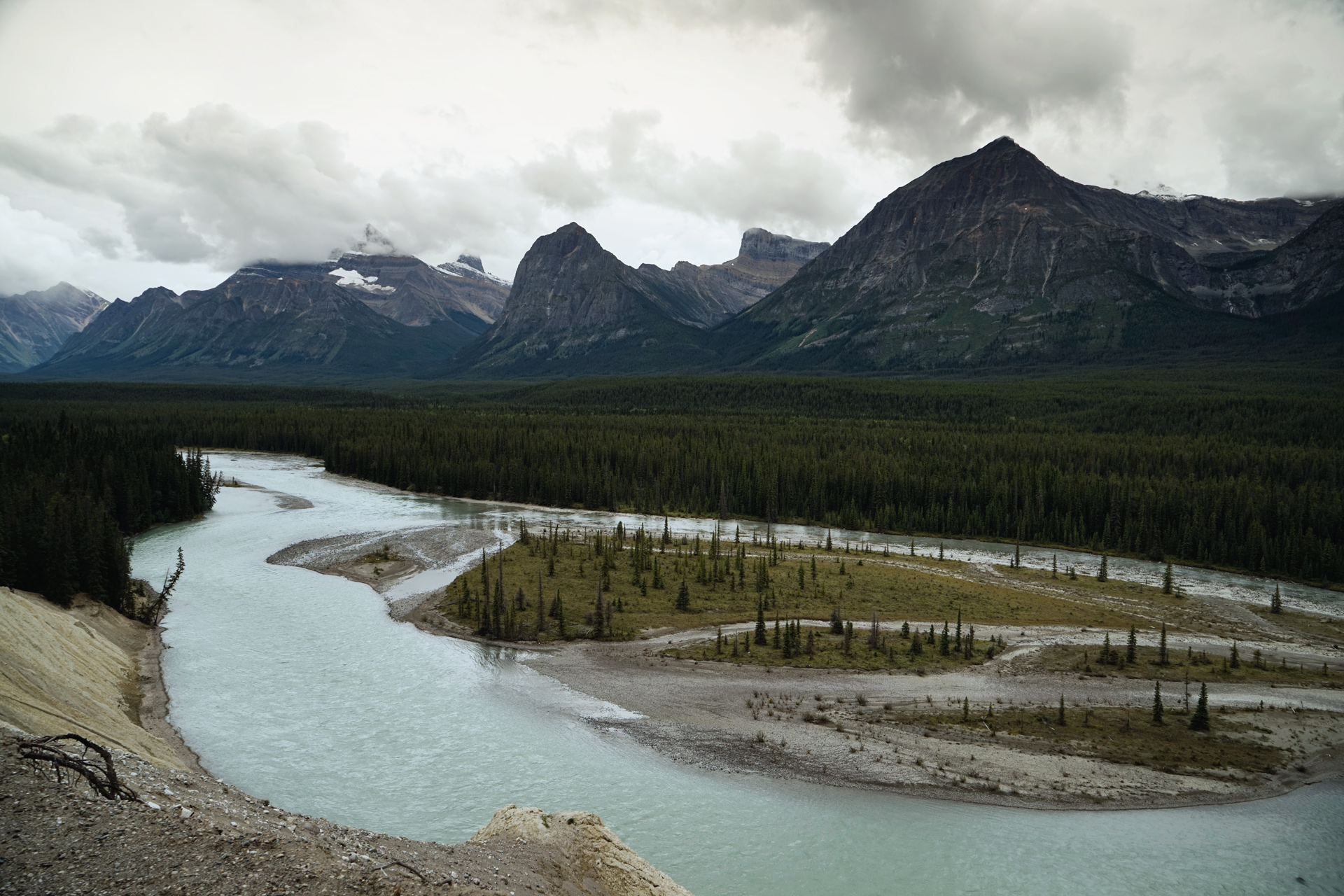
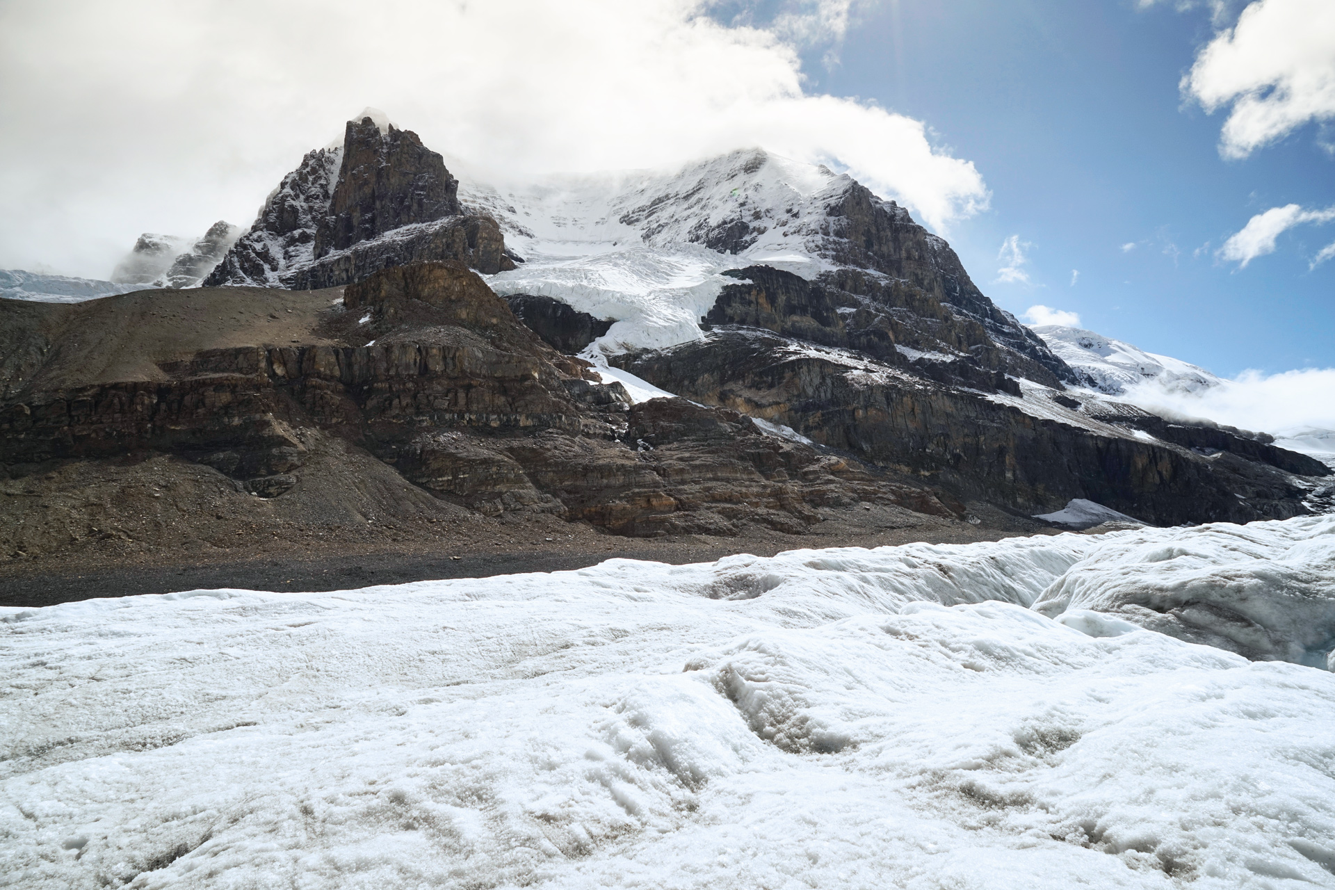
Icefields Parkway
The Icefields Parkway is 144 miles of road stretching from Lake Louise through the heart of Jasper National Park.
It has been called one of the most scenic driving experiences in the world.
Most tours will only take you as far north as the Columbia Icefields Discovery Center, where you can walk on the Athasbasca Glacier.
For a more complete experience, you should aim your car to destinations further north.
Starting on Alberta Highway 93 just north of Lake Louise, here are just a few of the sights along the way.
The Crowfoot Glacier: 51.662838, -116.438462
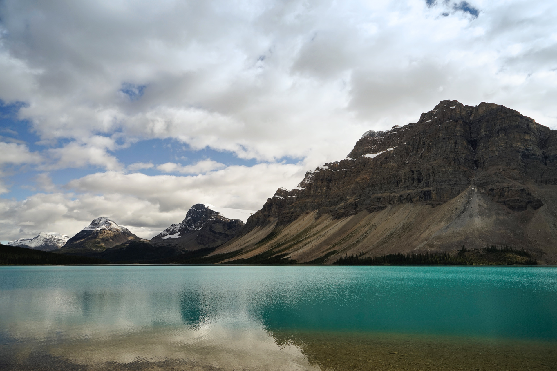
Bow Lake: 51.678081, -116.467171
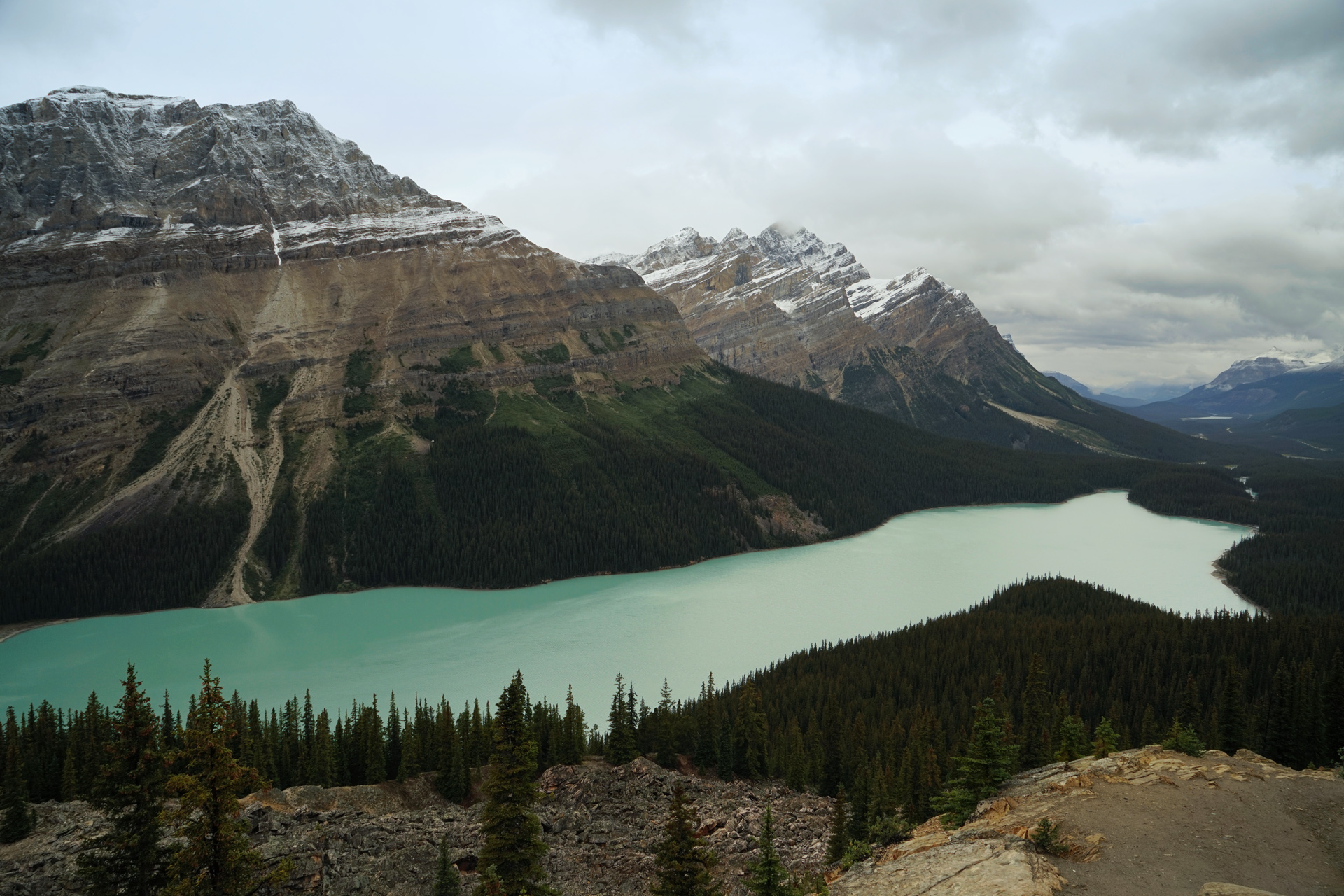
Peyto Lake from the Bow Summit viewing platform: 51.716682, -116.506285
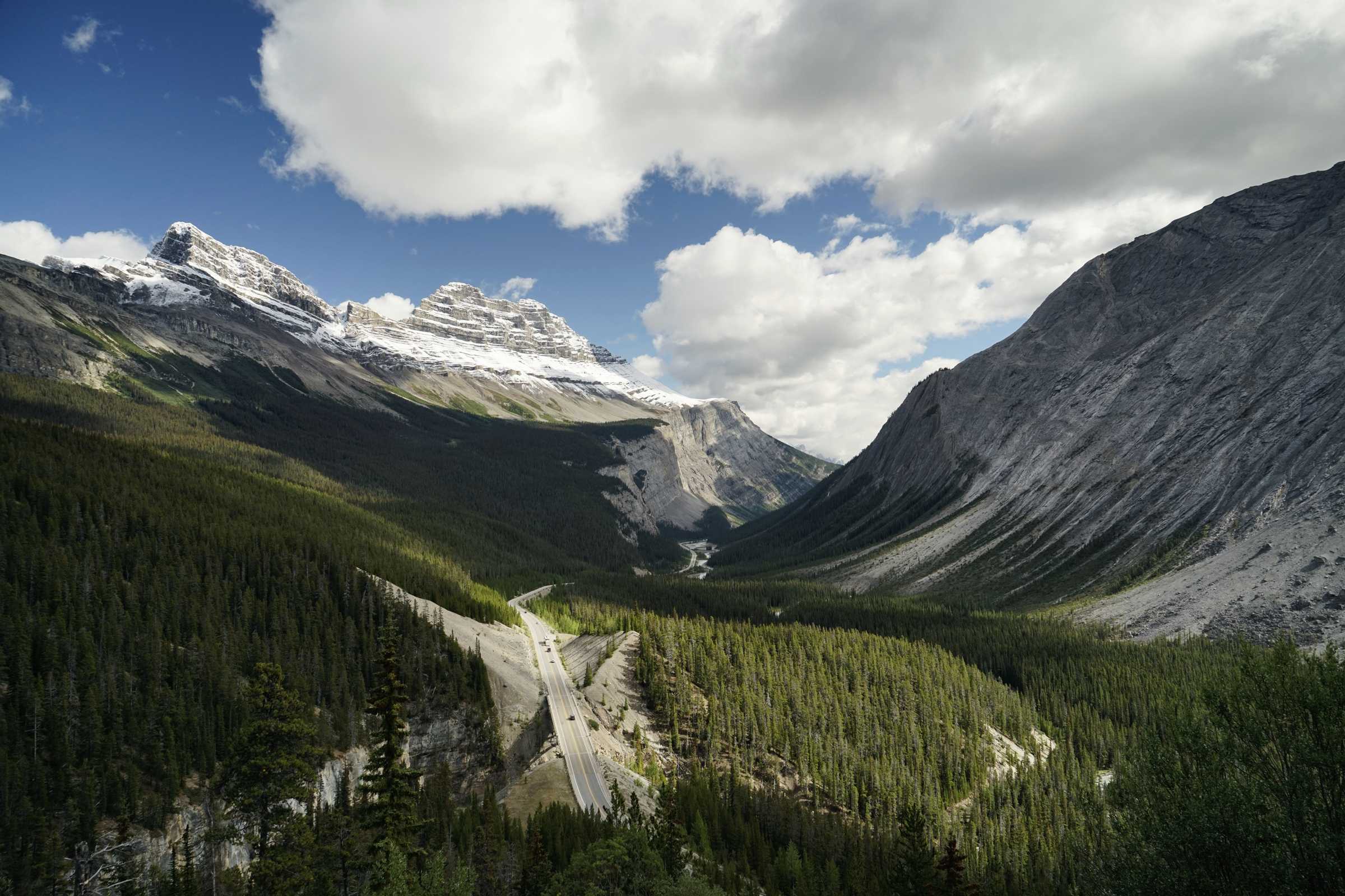
Cirrus Mountain from the Icefields Parkway: 52.176649, -117.055314
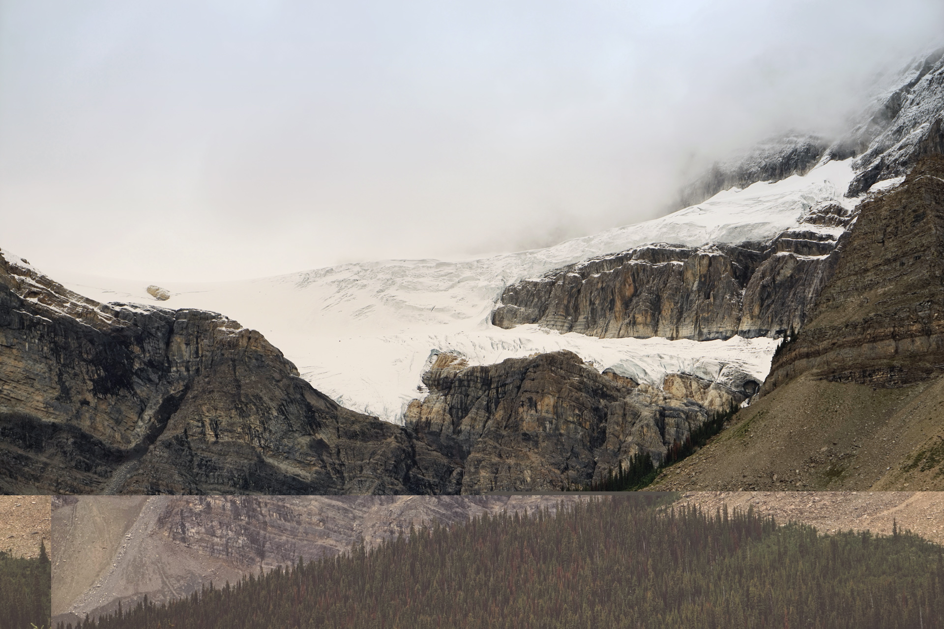
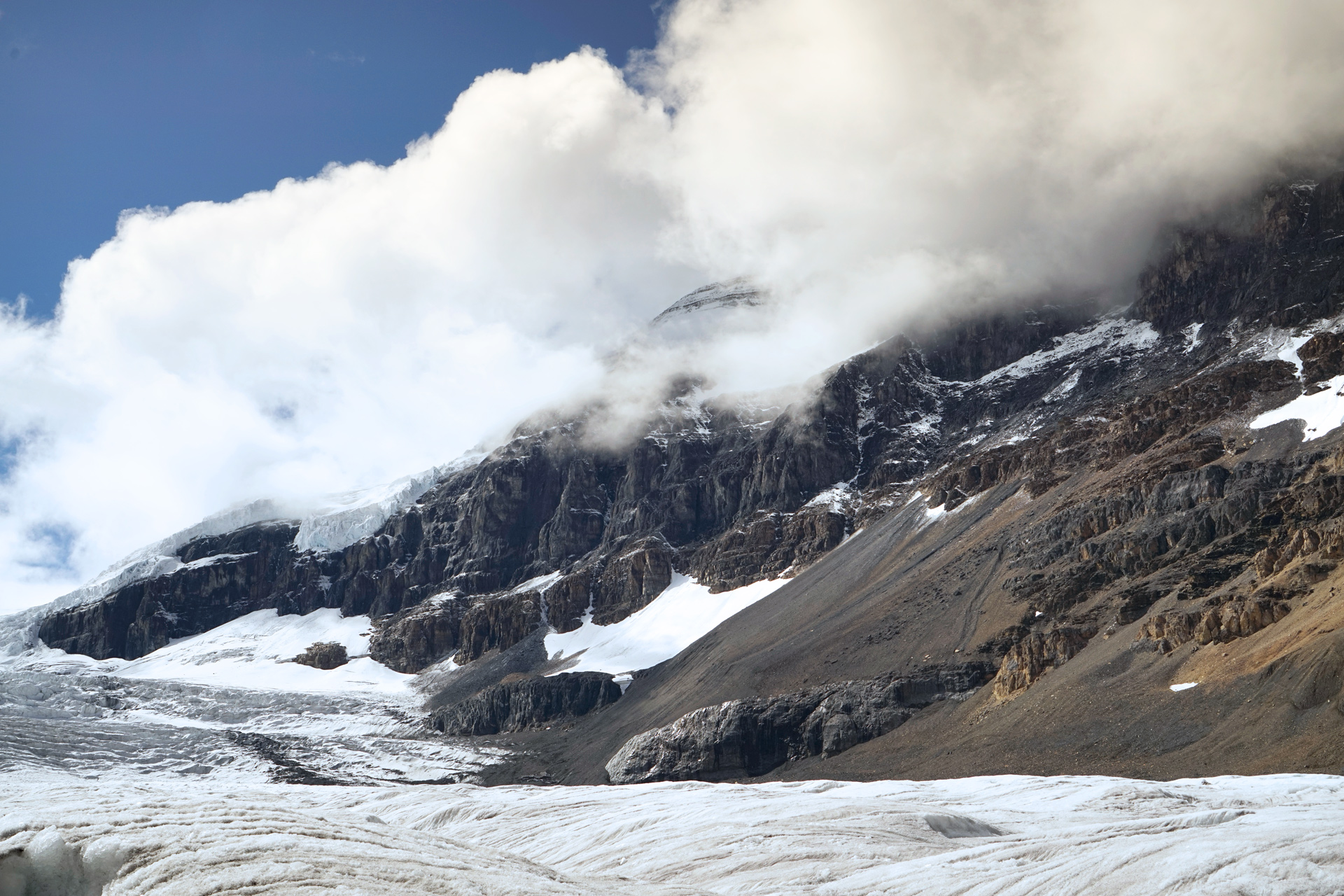
The Athabasca Glacier
Walking on the Athabasca Glacier was one of my favorite memories of the trip.
Because of its location along the Icefield Parkway halfway between Lake Louise and Jasper, it is the most visited glacier in North America.
Parking at the Columbia Icefields Discovery Center across the road, you can take a tour bus directly to the glacier or hike over to it.
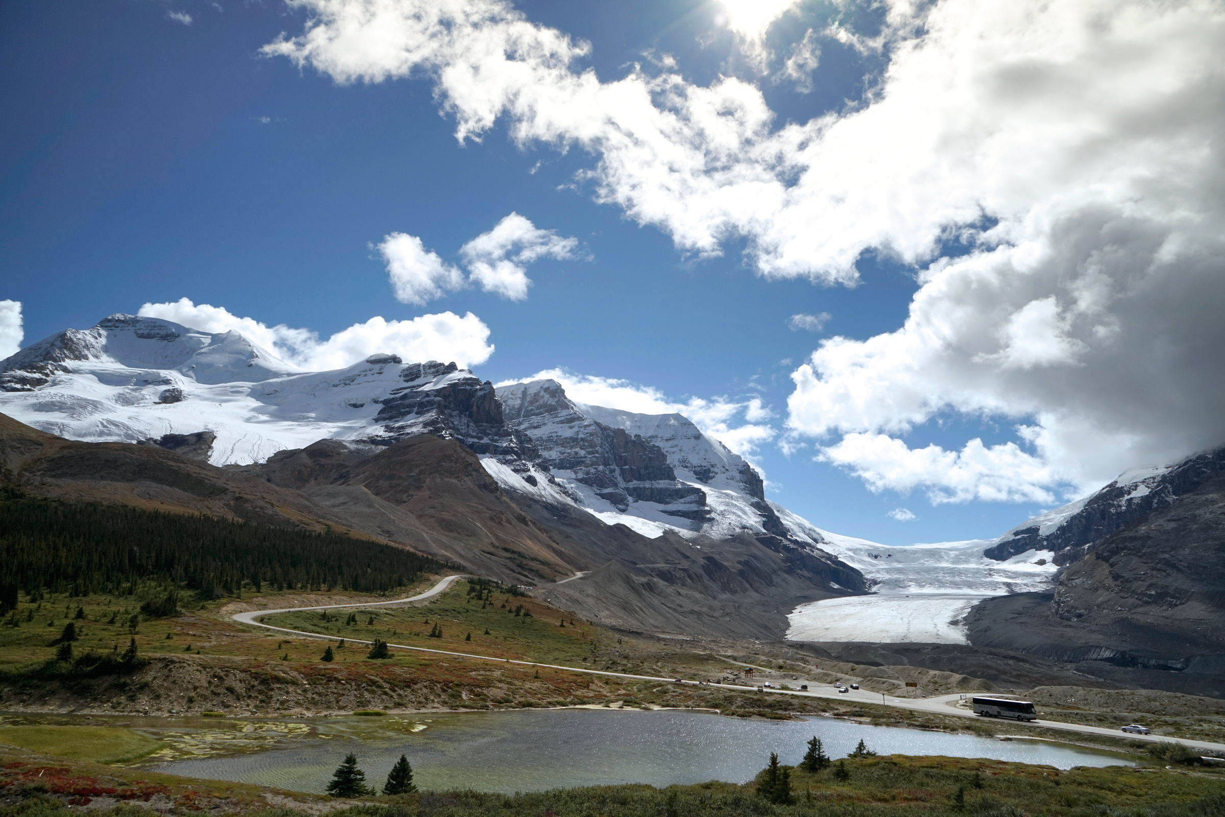
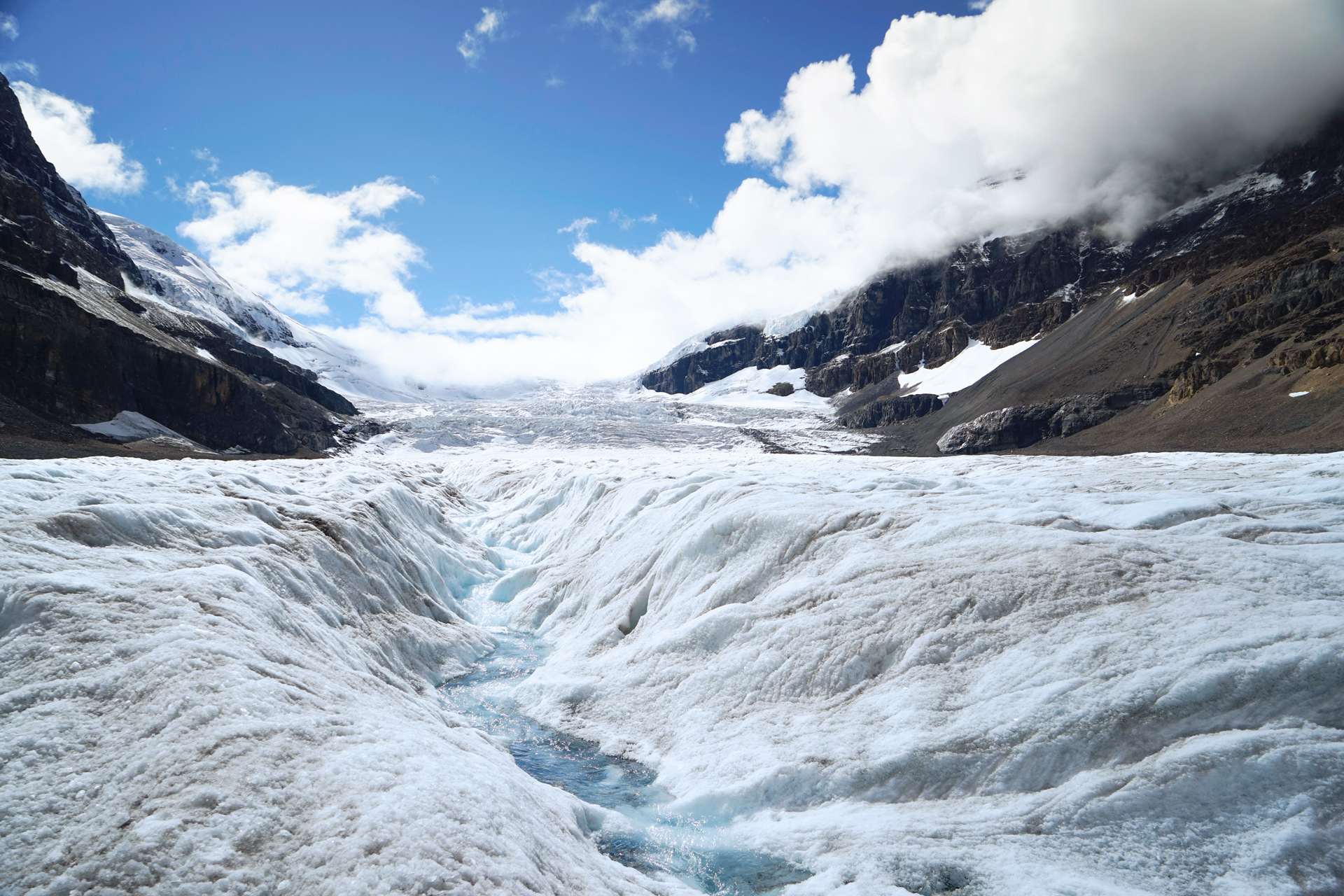
Parking is located at the Columbia Icefields Discovery Center: 52.220144, -117.222653
Hiking to Angel Glacier
2 miles out and back, 400 feet vertical gain
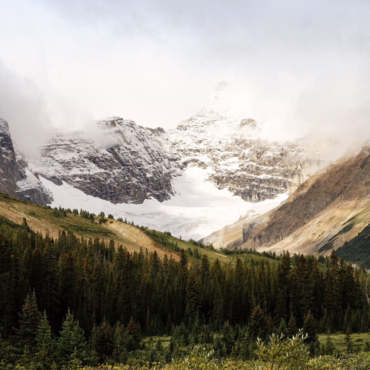
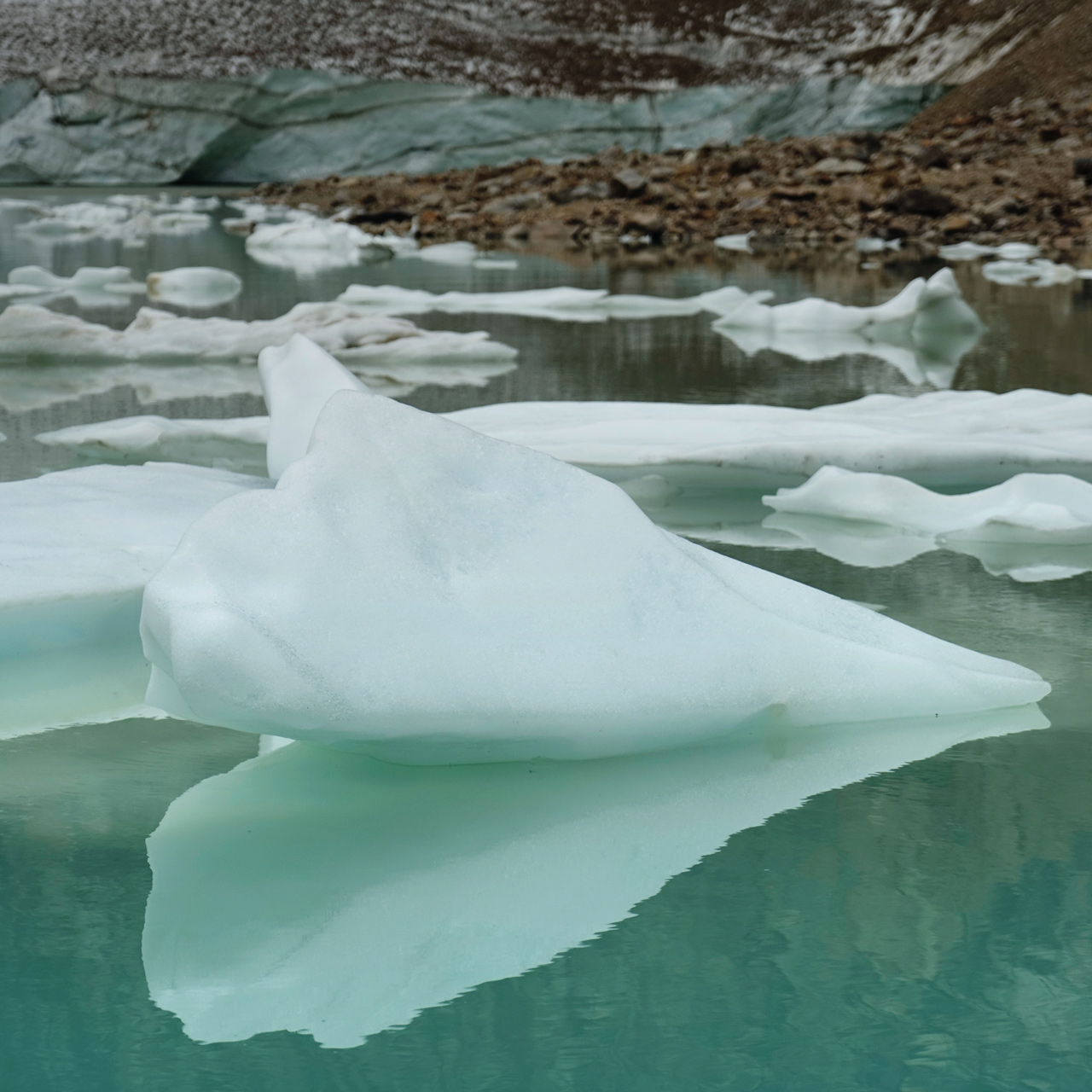
Angel Glacier floats above a glacial pond on the north face of Mt. Edith Cavell in Jasper National Park.
It is just one of the rapidly disappearing bodies of ice in the area.
Driving from Lake Louise, it is possible to hike to the Angel Glacier or further up the Edith Cavell Trail and return the same day.
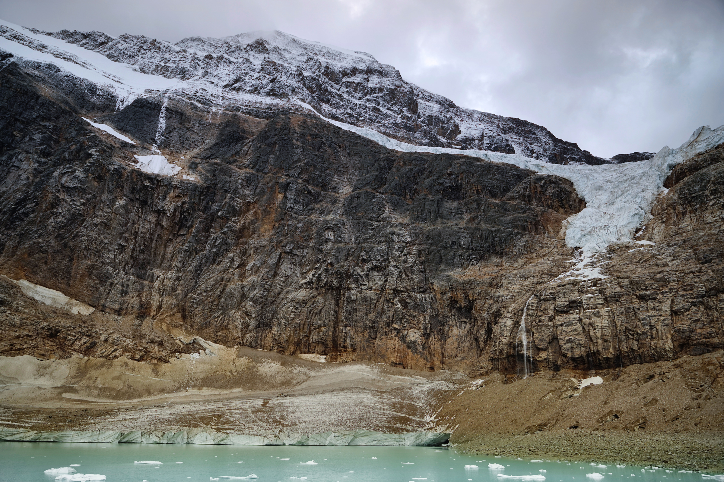
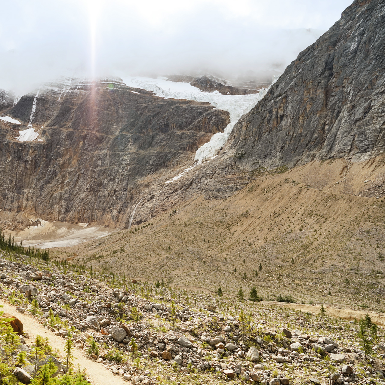
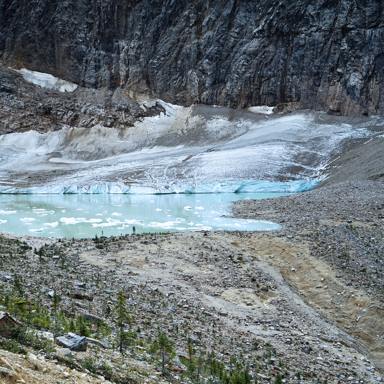
The Edith Cavell Trail starts at the parking area northwest of the Angel Glacier: 52.687389, -118.056306
Directions
Banff National Park is a 2-hour drive west from Calgary International Airport.
Lake Louise is the next major town along the Trans-Canada Highway, a 40-minute drive northwest from Banff.
The Columbia Icefield Discovery Center is a 2-hour drive northwest on the Icefield Parkway, and Edith Cavell Trailhead is another 2-hour drive from there.
Road alerts can be found on the 511 Alberta website.
1
Banff Gondola: 51.148242, -115.556040
2
Fairmont Chateau Lake Louise: 51.417335, -116.214977
3
Columbia Icefields Discovery Center: 52.220422, -117.223046
4
Angel Glacier Trailhead: 52.687389, -118.056306

More Stories